Lake Mead N.R.A.

Lake Mead N.R.A.
READY TO ROLL!
Showing posts with label Montrose. Show all posts

Monday, July 26, 2010

Owl Creek Pass

July 25, 2010.
Another beautiful day in the Montrose Valley. After a late start (around noon) we decided to take an off-road trail up and over Owl Creek Pass. Some locals had told us about it. They claimed it has some of the best views of any of the Jeep trails.
The Owl Creek Pass trail is 41 miles long. I had only plannned on doing a few miles and then turning back.
We saw this Red Tail Hawk in the road. He then flew off into this tree.
After about 12 miles into it, we decided to complete the whole loop of 41 off-road miles.

We had climbed to about 9K feet where the top and bottom picture were taken.
The locals tell us that some of the scenes for True Grit were filmed in this pasture as well as several Marlboro Man commercials. This pasture is just northeast of Ridgeway, Co. were there was additional filming in town.
At the summit, a mere 10K plus feet!
Still at the summit, we were chased off by swarms of flies shortly after taking this picture.


This young buck crossed our path. Notice the velvety horns.

We drove through many beautiful Aspen Forests like the one below.
When we finally got back to a paved road we were 21 miles east of Montrose. We drove into town washed the Jeep and filled it up in preparation for moving on in a couple of days. We are discovering that we are getting 18-22 mpg from the Jeep. The mileage is around 18 when off-road and low 20's on the highway around 60 mph.
The Jeep is great for off-road and around town. It's a bit underpowered at highway speeds over 60 mph, but I'm very satisfied with it. 

Sunday, July 25, 2010

Montrose Fair/ Rodeo Parade

July 24, 2010.
The day started off with beautiful sunny skies and cool temps. We got out early to go into the town of Montrose to watch the parade for the fair and rodeo that starts today.
We parked on Main Street about 9:30 and looked around for signs of a parade. We were told the parade would be at 10:00. There weren't many people around. We walked into a local breakfast joint and asked about the parade. They advised after pausing that yes today is the day of the parade. So we sat outside and had some breakfast as we waited.
Around 10:00 the parade started with the local police blocking Main Street. 


I gotta tell ya it was the most pathetic parade we have ever seen! 

But it was fun anyway as we got a chance to talk with some of the locals and explore some of the shops on Main Street.
Afterwards we did some shopping in town and picked up some more of the Olathe Sweet corn. Back home it was getting warm and humid. We ate lunch and took a short afternoon nap. After dinner we attended the park's "ice cream social" and enjoyed talking and meeting folks.
Just another leisurely day, enjoying the RV lifestyle.

Friday, July 23, 2010

Hike in Black Canyon of the Gunnison National Park

July 22, 2010.
The weather cleared overnight here in the Montrose Valley of Colorado. We awoke to cool and overcast morning. A perfect morning to go hiking. We had planned to get up early i.e. 7:00. but, we slept till 9:00! So we got off to a late start with no one to blame but ourselves.
We walked the dogs and got our Camelbacks loaded and hit the road for the 25 mile drive to the Black Canyon of the Gunnison. We took off on the Rim Rock Trail.
The Rim Rock Trail does exactly as it sounds, it follows the south rim of the canyon allowing for breathtaking views.

There are plenty of photo opportunities and we took a lot of photos. Somehow, the pictures can't capture the depth and beauty of the canyon.
The trail was rocky and filled with some up and down elevation changes. The trail itself is at 8000 ft.


After completing the Rock Rim Trail, we did a portion of a steeper trail, the name of which escapes me. We had a great time coupled with some good exercise. We were finished after just a few hours and headed back home but not before stopping in Montrose to buy some corn. The first harvest of Olathe Sweet Corn is being sold out of the bed of pick-up trucks in town. It's such a mainstay of the community that they have an annual sweet corn festival. We had heard that it's some of the best corn you'll ever taste. So we bought a half dozen ears (they were small).
Back home it was still cool and overcast so I decided it was a perfect time to get up on the roof of our Carriage Cameo fifth wheel to do the annual A/C maintenance which consists of blowing out the evaporator coils. So I got out the air compressor, started it up on the ground and pulled the hose up to the roof. I pulled both A/C covers off and thoroughly blew out all the leaves, sticks and debris hidden inside. I then focused the compressed air on the coils making sure they were cleared of dust and dirt.
With that job done it was soon time to boil the corn and have dinner. I gotta tell ya, the corn was fabulous! We will be getting more!


Thursday, July 22, 2010

Rainy Weather and Chillin' at Home

July 20-21, 2010.
The last couple of days have been stormy and rainy. However the rain has been welcomed as it served to bring the temperatures down to the 70's during the day.
We stayed home due to the inclement weather and missed our scheduled hike in the Black Canyon of the Gunnison National Park. So we post-poned it. We have a flexible schedule...we're retired! We worked on cleaning up the rig between storms and playing a little ping pong in the club house.
We found a new paved loop outside the park to walk Maggie and Rico. We are able to let them run off leash and they enjoy the new found freedom. The other day Maggie took off across a field and fell into a ditch. You think that would have caused her to pay more attention, but no... she came running back to us and fell into a ditch full of muddy water!

Tuesday, July 20, 2010

Black Canyon of the Gunnison National Park

July 19, 2010.
Another warm day in Montrose with temperatures expected to reach 98 degrees in the city. We are a few miles south of town at about 6200 ft. a few hundred feet higher and away from the concrete of the city so it's not as warm in the campground. 
We made a decision to stay here at Country Village RV Resort for another week. There's plenty to see and do in the area and we aren't in a rush to move on.
Montrose serves as the gateway to the Black Canyon of the Gunnison National Park to the east of town, and winter transportation hub to ski areas of the San Juan Mountains to the south. In 1909 the Gunnison Tunnel opened providing irrigation water from the Gunnison River in the Black Canyon to Uncompahgre Valley helping turn Montrose into an agricultural hub as well.
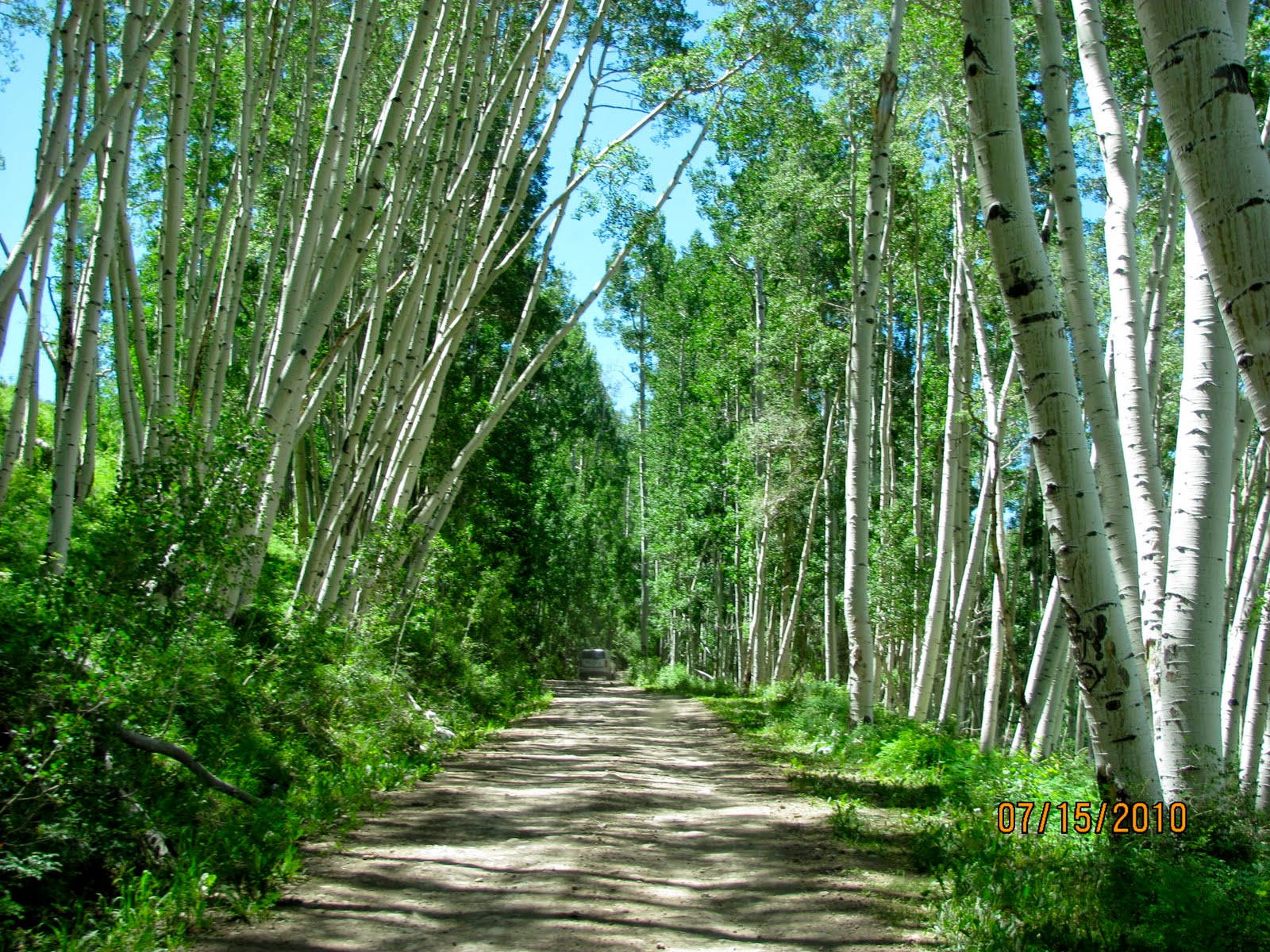
We took a trip out to the Black Canyon of the Gunnison National Park. It's about 50 miles round trip from our site.
Most rivers of the Southwest cut through relatively soft sedimentary rock, forming canyons that tend to be quite wide, colorful and stepped - descending in a series of cliffs and ledges through layers of differing hardness. When rivers flow across harder igneous rock they produce steeper gorges, spectacular in different ways, such as Hell's Canyon in Idaho, the deepest in the US, or the multicolored Grand Canyon of the Yellowstone in Wyoming.

One of the steepest, darkest and most rugged of such canyons is formed by the 
Gunnison River as it flows through hard ancient rocks at the western edge of the Rocky Mountains, on its way to joining the Colorado river at Grand Junction.

A New National Park: On October 21st, 1999, Black Canyon was officially upgraded in status from a national monument and became the 55th national park in the US, and the third smallest. Entrance fees increased sharply on Jan 1st 2007, from $8 to $15 per vehicle.

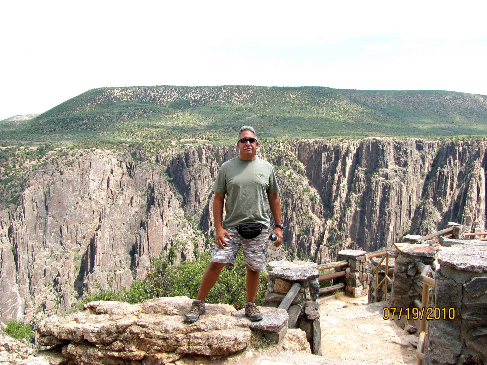
We paid the $15 admission fee to the park which is good for a week. The park consists of two paved scenic drives along the north and south rims of the canyon and another paved drive down to the Gunnison River. There are several scenic overlooks along the rim drives.


Below, this overlook is behind the small visitor center inside the park.

The canyon walls are composed of volcanic schist, predominantly black in color, and as the gorge reaches depths of over 2,000 feet while often being only 1,500 feet across, sunlight illuminates the walls only briefly, hence the name 'Black Canyon'. It is unsettling, almost frightening to stand at the very edge of one of the canyon overlooks, such is the menace and sheerness of the jagged rocks below.

You can just make out the Gunnison River over Joyce's shoulder.

The canyon was originally over 50 miles long, but three dams have been built along the eastern (upstream) section flooding two thirds of the gorge - this is now part of theCurecanti National Recreation Area (NRA) which offers many recreational opportunities based around the artificial lakes. Only the lower 13 miles of the canyon remain unspoilt but this includes the deepest and most scenic section.

We traveled the 8 miles along the South rim getting out at the many view points. Most of the view points required short hikes of a few hundred yards back and forth so it got to be a little tiring towards the end at an altitude of 8500 ft. coupled with the hot weather. Admittedly it also gets to be a little repetitive looking into a canyon but, that didn't stop me from giving Joyce grief for not getting out of the Jeep at the last stop!

With our pass good for the week, we made tentative plans to return and hike at least one of the designated trails in the park.

Friday, July 16, 2010

Last Dollar Road and Telluride

July 15, 2010.  Warning lots of pictures!
This morning temps were in the low 70's and expected to warm to the upper 90's. We decided to take an off-road adventure on Last Dollar Road, rated as "easy" in our Colorado off-road book.
The Last Dollar Road was an early supply route from Ouray to Telluride. It is not a difficult trail, and the road can be driven by high clearance 2 wheel drive vehicles in dry weather. Four wheel drive is required in any wet conditions. The Last Dollar Road offers beautiful vistas, high alpine meadows and views of the San Miguel canyon.
The Last Dollar Road starts off on a dirt County Road going past small ranches with fields of beautiful flowers.
The dirt road travels over high hills overlooking beautiful valleys.
Before long you turn off the County Road and begin driving on an increasingly narrow dirt road that begins to turn up into the mountains.
It's wet in spots from little streams that trickle down the sides of the mountains. 
We drove through Aspen Forests. You can see another Jeep (that we later passed) ahead of us in this picture.
The Aspen Forests give way to beautiful mountain vistas.
Joyce thought I was gonna do a "Thelma and Louise" and launch ourselves off this cliff!

She was screaming like a school girl!
The views from the top were breath taking.
As we got higher we entered a pine forest.

The beautiful San Juan Mountains in the distance.
The road at this altitude was very narrow, rocky and full of ruts. I would not have been comfortable in anything but a Jeep or ATV. The road was too narrow in my opinion for a pick-up truck.

Thankfully, we didn't encounter any other vehicles going the opposite direction.
 We began our descent into Telluride passing more privately owned farm land. 
The road widened to a graded county maintained road.
We arrived in Telluride no worse for the wear after 20 miles of dirt roads and additional highway miles. It took us about an hour and 45 minutes of driving on the Last Dollar Road
Telluride is located at an elevation of 8,750 feet in an isolated spot in the Four Corners region where ColoradoNew MexicoUtahand Arizona come together. From the west, Colorado Route 145 is the most common way into Telluride, however there are two alternate passes to enter the town as well.
The Town of Telluride is the county seat and most populous town of San Miguel County in the southwestern portion of the U.S. state of Colorado.[3] The town is a former silver mining camp on the San Miguel River in the western San Juan Mountains. TheTelluride Historic District, which includes a significant portion of the town, is listed on the National Register of Historic Places and is also one of Colorado's 20 National Historic Landmarks. The town population was 2,221 at U.S. Census 2000.
Telluride sits in a box canyon. Steep forested mountains and cliffs surround it. Bridal Veil Falls is at the head of the canyon. Numerous weathered ruins of old mining operations dot the hillsides. A free gondola connects the town with its companion townMountain Village, Colorado at the base of the ski area.
Telluride and the surrounding area have featured prominently in pop culture. The town of Telluride has served as the backdrop for several television commercials, is home to an international film festival, and has been the subject of songs such as "Smugglers Blues" by Glenn Frey, an essay by Edward Abbey, and eponymous songs by The Nitty Gritty Dirt BandKate Wolf, and Tim McGraw. Telluride is also known for its ski resort and slopes during the winter as well as an extensive festival schedule during the summer.
Beyond the ski lifts, Telluride is now widely recognized as a premier all-season resort. Telluride Ski Resort is definitely the main attraction in the winter. But when summer comes around, Telluride transforms into an outdoor recreation hot spot, with tourists visiting to enjoy a wide range of activities including but not limited to mountain bikinghiking, river rafting, sightseeing and more. The Telluride Tourism Board promotes tourism in the region.
After walking around town and avoiding the over-priced tourist shops, we stopped at an outdoor taco stand (imagine that) for lunch. Later we drove to the east end of town where the only way out is up and over Bridal Veil Falls and the two 4x4 passes.
On the eastern side of town, or the falls side, Bridal Veil Falls and the Generator House which sits at the top of the falls overlook the Victorian section of town. The power plant house is owned by Eric Jacobson, who restored the house and the generator inside, which now provides about 25 percent of Telluride with its electricity. The house was originally used to power the Smuggler-Union Mine and requires an aerial tramway for Jacobson and his family to get home. It is the second-oldest operating AC generator in the United States, the first being the Ames Hydroelectric Generating Plant near Ophir, Colorado, also in San Miguel County.
There is at least three falls. Bridal Falls and the generator house are in the picture below just right of the picture above.


We had a great time especially on the off-road trip to Telluride. However, we took the much faster highway on the way home!