Lake Mead N.R.A.

Lake Mead N.R.A.
READY TO ROLL!

Saturday, August 7, 2010

Canyon Motel & RV Park, Williams, Arizona

Aug 6, 2010.
The last few days have been occupied doing domestic chores around the rig along with some short excursions. Last night we rode our bikes in the evening into Williams to sit outside and watch the people cruising the Historic Route 66 Main Street. We have very good lights for our bicycles so we felt comfortable riding at night on the way home. It was a cool and beautiful evening.
We are staying at The Canyon Motel & RV Park. It's located about a couple miles from the Main Street of Williams, Az.
The Canyon Motel & RV Park has a few rental rooms that are converted train cars..kinda neat. Most of the rooms are in the standard cottage style buildings.
The cottages and trains are near the entrance. The sloping RV park is located directly behind the cottages and the office/ retail shop. There is a small indoor wading pool in the park however, it has been closed for repairs.  Although advertised as being in the Ponderosa Pines, except for a very few sites, there are no trees in the RV park as it's an open gravel parking lot with some areas of weedy greenery. The majority of the sites are pull throughs, but be aware the sites are generally not level.
I-40 is visible and can be heard at night to the north of the park. There are at least two train tracks in the area. One north and The Grand Canyon Railway runs just south of the park. You can see the The Grand Canyon Railway train passing in the picture below which is the view from our site.
We are in Site 14 and are paying $761 for a month including electricity with full hook-ups. I've noted the voltage readings on the power are minimal. So far we haven't had the need to run the a/c and I don't plan to use the a/c due to the minimal and fluctuating voltage. At times, my AC Volt Meter is reading barely 112-114 VAC. 
Temperatures here in Williams, Az. have been very moderate with lows in the 50's and the highest at 83 degrees for about an hour.
The lower part of the park had flooded a few days before our arrival due to excessive rain. The flooding reportedly damaged the pool. Our site backs up to a residential neighborhood. The empty residential lots behind our rig are full of sunflowers that are in full bloom.

The park advertises WiFi however it is virtually non existent. We've talked to some folks in the park that return every year. They have told us that the low voltage and poor WiFi have been a problem for years. Yet this park seems to be the best if not one of the best in the area. 
All things considered we are satisfied with this park for the next month as there are lots of things to see and do in the area. We plan to take our time and relax cutting back from the fast paced touring that we've been guilty of. It's very easy to get sucked into the constant vacation mode and forget that this is our lifestyle and not an extended vacation.  We need to slow down and smell the roses!
Yesterday we drove the truck into Flagstaff, 30 miles away via interstate 40. We did some restocking of groceries and purchased a hitch from U-haul for the jeep. Back home I installed the hitch on the jeep for the purpose of mounting our bike rack and thus being able to take our bikes with us for exploring.
It's the same bike rack that we use on the kingpin of the fifth wheel. However, it doesn't fit properly on the Jeep. The latch that collapses the rack down also hits the spare tire if you try to open the rear door. However, it will work for now.
Another reason for staying a month in Williams is that we are slowly headed for our 2nd Volunteer (workamper) experience. We've accepted a government volunteer position for a few months near Lake Havasu, Az. We are expected by October 1 but we may entertain arriving earlier if the temperatures come down a bit in Havasu!  I'll post more about that position in the near future.

Wednesday, August 4, 2010

Travel Day to Williams, AZ "Gateway to the Grand Canyon"

August 3, 2010.
It was a cool morning and we made our final preparations before getting hitched up and pulling out. I had hoped to be on the road by 8:00, but we weren't on the way till 9:00. Our delay was in part because I was trying not to disturb our neighbors early in the morning. Our immediate neighbor usually was gone by 7:00 but today they slept in. Moreover, their truck was positioned to make pulling out of my tight space difficult. As I was making ready and beginning to hitch up another neighbor came over to talk. I enjoy the friendliness of the folks we meet in the campgrounds, but I don't like being bothered when I'm hitching or unhitching. Conversation can break the routine and cause me to miss something. Anyway, all went well.

I was expecting a nice smooth ride. Or should I say I was hoping for a nice smooth ride for the 300 miles to Williams Az. By now you know I don't like to travel much over 200 miles a day and prefer 150 or so. However, there wasn't much in the way of campgrounds between Monticello, Utah and Williams, AZ. so the plan was to press on!
But instead the ride was full of beautiful scenery but also twisting turning steep canyons and this rather unusual bridge (in the desert). 
We were traveling near Monument Valley on Navaho Reservation property.
There wasn't much traffic on Hwy 191 and at times it seemed like we were the only ones out in the middle of nowhere. But the scenery more than made up for the desolation.

A few pictures from Joyce's perspective! As you know, Joyce follows the dogs and I in her Jeep.

Every few miles we would pass a little stand on the side of the road (trading posts), were the Navaho people would be selling trinkets and jewelry.
We stopped in Tuba City for a break at a local cafe that looked to have once been a McDonalds' truck stop. It turned out it was now a Native American cafe. However, it was filthy and expensive. So we didn't eat and just snacked on crackers while we let Maggie and Rico take a break. I also emptied the two 5 gallon cans of diesel I carry into my truck. 300 miles is near the maximum range which is apx. 350 while towing so, I like to have that reserve. As you know I'm not fond of pulling into fuel stations with my rig, so I avoid it whenever possible. 
As we neared Flagstaff, Az. we encountered a heavy rainstorm but thankfully we drove out of it and on to I-40 for the last leg.
We made it safely to The Canyon Motel RV Park in Williams, Az. "The Gateway to The Grand Canyon". We traveled over 300 miles in 6.5 hrs. We will be staying for a month. Now I gotta say, Joyce picked this one as she didn't like the park I picked in Utah!
I was impressed to see that the Jeep got over 23 mpg during this trip. Which is good considering the local gas stations here in Williams are at $2.85 for a gallon of regular gas. I think the good gas mileage is due impart to the fact that we drive @ 60 mph or less. I think my truck and rig got over 10 mpg, but I'll have to fill the tank and work the numbers. 
After arriving we were famished and decided to go into Williams, Az. a mile away for dinner. Dinner was good and we walked around the Historic 66 downtown district. It's a very small very touristy town, but so far we like it!

Williams, Az. and Route 66

Williams, Arizona would go down in history as being the last town to have its section of Route 66 bypassed. The original plan was to have the last section of the famous highway bypassed somewhere in Texas, but lawsuits that had been filed kept the last section of Interstate 40 from being built around Williams. After settlements called for the state to build three exits for the town, the suits were dropped and I-40 was built. In 1984, Interstate 40 was opened around the town and newspapers the next day reported the essential end of the famous US 66. The following year, Route 66 was decommissioned.

My next post will contain pictures and information on the campground. We plan to stay here for at least a month, so stay tuned!

Monday, August 2, 2010

Moab, Utah

August 2, 2010.
The last couple days, we were besieged with rain and thus, stayed around the campground. Needless to say, we developed a good case of cabin fever. So, today we took a drive out to Moab, Ut. @ 100 miles round trip. On the way we stopped at Hole N' The Rock off hwy 191. 
It's conveniently located about half way between where we are staying in Monticello and Moab. It's a cute little tourist stop with at least three souvenir shops and lots of interesting things to see.
Joyce posed in front of a bull, one of many art statutes in the yard.

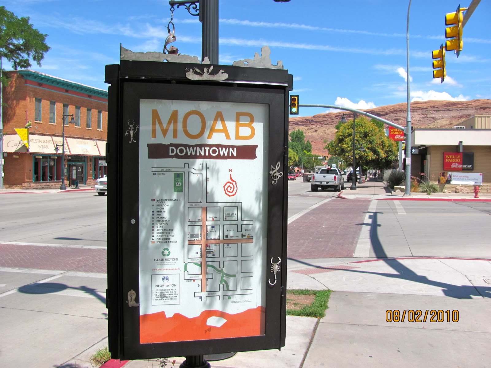
We parked downtown in Moab and walked around the town. You can see our truck parked along the side of the road in the picture below. We took the truck because we've put almost 2400 miles on the Jeep since buying it in June.
Moab is a an interesting, modern town that obviously thrives on tourism. There are a plethora of souvenir and T-shirt shops along Main Street.
The temperature in Moab was pushing 90 +. In comparison it was in the upper 70's when we left Monticello. We visited the visitor center and could over hear the employees warning visitors of the dangers associated with heat from hiking and biking during this time of the year out on the many trails. Afterwards Joyce and I discussed it and we decided that we would likely return to Moab in the late winter or early spring months to take advantage of the excellent hiking and biking opportunities.
We strolled the shops along Main Street and then stopped at a local cafe for lunch. By the time we were ready to head home, the storm clouds had built up to the south in the direction we would be headed.
I loved the silhouette of the mountains to the west of Moab.
Fortunately, most of the rain moved off as we drove south. We pulled off Hwy. 191 to photograph the Wilson Arch on the way home.
Wilson Arch, also known as Wilson's Arch, is a natural sandstone arch in southeastern Utah along U.S. Route 191 located 24 miles south of Moab. It has a span of 91 feet and height of 46 feet.[1] It is visible from the road to the east where there are turnouts with interpretive signs. The elevation of Wilson Arch is about 6150 ft.[2]
According to the sign at the pulloff near the arch:
"Wilson Arch was named after Joe Wilson, a local pioneer who had a cabin nearby in Dry Valley. This formation is known as Entrada Sandstone. Over time superficial cracks, joints, and folds of these layers were saturated with water. Ice formed in the fissures, melted under extreme desert heat, and winds cleaned out the loose particles. A series of free-standing fins remained. Wind and water attacked these fins until, in some, cementing material gave way and chunks of rock tumbled out. Many damaged fins collapsed like the one to the right of Wilson Arch. Others, with the right degree of hardness survived despite their missing middles like Wilson Arch."[3]

Back home we made some final preparations to move on tomorrow.