Lake Mead N.R.A.

Lake Mead N.R.A.
READY TO ROLL!
Showing posts with label Buena Vista. Show all posts

Wednesday, July 13, 2011

Doing some off-road Jeeping and Big Horn Sheep

July 13, 2011 Buena Vista, Co.
This morning we made some preparations to move on to Gunnison, Co. tomorrow. One of those preparations involved lowering the fifth wheel hitch in the truck. Lately, I've noticed that the rear tires on the trailer are wearing slightly faster than the front. They are wearing evenly so I don't suspect an alignment issue. However, I've been reading of similar problems in the forums related to fifth wheels that are towed while not level, specifically with the front too high. I've noticed that my front is also high although, I never thought it was too high. Anyway, I lowered my hitch today 2 inches. I wish it had an inch increment but it doesn't. I haven't hitched it up to check it out so, I'll have to wait till tomorrow to see if it's going to work in terms of truck bed clearance and leveling. If it's not a good fit, I'll have to reset the hitch tomorrow (moving day) which may take an hour.
Our neighbors hear at the park are avid Jeepers and ATV riders. They convinced me that I should take Joyce out for a ride that they did yesterday in their Jeep. We generally don't do much of anything the day before moving but we decided to try the recommended Jeep trail just outside of Buena Vista known as the Four Mile Trail System. The name is misleading as it's much longer than four miles.
Our 2010 Wrangler Unlimited Rubicon
Now to be clear, we are not experienced 4-wheelers and we are really not into doing anything that would potentially damage our Jeep.  That being said we do like to ride off-road but we carefully select routes whenever possible. I think we would enjoy it more if we had the opportunity to caravan with other Jeeps.
A River Runs Through It as we are entering the area.

Sign at the start of the Trail.
Looking Up the Road 
Beautiful Views as we climbed.
The road was narrow and banked in many areas probably from ATV use.


Easy going on the high plain.

Aspens
Climbing to over 9400 ft.
We thought the Jeep road was pretty gnarly in many spots and steep or rocky in others. I used 4-Low in several places because of the steep ascents and descents. Of course we didn't get good pictures of the rougher spots as we were both busy hanging on!
We came around a curve and found these three Rocky Mountain Bighorn Sheep on the side of the road eating leaves and grazing!
We stopped to take pictures and watched all of them cross the road in front of us. All three were rams (males) and didn't seem to be concerned with us.

Rocky Mountain Bighorns inhabit the mountains from Canada south to New Mexico. They are relatives of goats, and have balance-aiding split hooves and rough hoof bottoms for natural grip. These attributes, along with keen vision, help them move easily about rocky, rugged mountain terrain.


Wild sheep live in social groups, but rams and ewes typically meet only to mate. Rams live in bachelor groups and females live in herds with other females and their young rams. When fall mating arrives, rams gather in larger groups and ram fighting escalates. Usually only stronger, older rams (with bigger horns) are able to mate.
In winter, bighorn herds move to lower-elevation mountain pastures. In all seasons, these animals eat available grass, seeds, and plants. They regurgitate their food to chew it as cud before swallowing it for final digestion.
It was a beautiful day and we really enjoyed venturing off-road again. Seeing the Rocky Mountain Big Horns was priceless!
End of the Jeep Road.

Tuesday, July 12, 2011

St. Elmo, A Mining Ghost Town REDUX and Hanging with Friends

July 12, 2011 Valley Mobile RV Park.
Saturday the 9th, a young friend, Nicki D. whom we had met as an intern at the Bill William's River National Wildlife Refuge came over to visit with us for the weekend. She has been working nearby in the Gunnison, Co. area doing hydrology work. We had all bonded instantly when we met at the NWR and we all stayed in touch through this blog and FaceBook.We were thrilled to see her and have her stay with us over the weekend. 
Saturday afternoon, we took a trip in the Jeep up Mt. Princeton to the old mining town of St. Elmo. On the way up we stopped for a picnic lunch and to remove the Jeep tops.
Nicki D. and Joyce
Nicki D. and Me
The weather was cooperating but threatening to rain as we reached the old mining town of St. Elmo. Joyce and I had visited last year but were pleased to take Nicki to St. Elmo.
St. Elmo
Joyce and Nicki D. outside a St. Elmo Home
St. Elmo is a ghost town in Chaffee CountyColoradoUnited States. Founded in 1880, St. Elmo lies in the heart of the Sawatch Range, 20 miles southwest of Buena Vista. Nearly 2,000 people settled in this town when mining for gold and silver became evident. The mining industry started to decline in the early 1920s, and in 1922 the train discontinued service. The community is listed on the National Register of Historic Places asSt. Elmo Historic District. It is one of Colorado's most preserved ghost towns.


After leaving St. Elmo we decided to take a side trip to the Iron City Cemetery. It's an interesting cemetery in that it is the final resting place for many of the folks who once lived in St. Elmo and the Iron City an old smelter and mining town. A sign at the entrance lists the names of the deceased and the cause of death for some of the folks.
We left the cemetery as the clouds continued to gather above us and continued down the road which we were told was the old stagecoach route and suitable for 4wd high clearance vehicles. We didn't get far before we pulled off at an abandoned old building and put the tops back on the Jeep as it was raining pretty hard. While putting on the tops we saw a pick-up followed by a sedan go down the road ahead of us. We got back on the old stagecoach road and continued down the now very wet and rocky road.  We were surprised to see that the car was able to negotiate precariously down the road over large rocks and wet conditions. I'm sure he was scrapping the bottom of his car and wishing he hadn't followed his friend. I say they were friends because both vehicles had Florida tags. However, they were already committed as there wasn't any place to turn around. I'm just glad they didn't get stuck in front of us!
After only a few miles we made it back to the main road and continued down the mountain and back home.
Later we all went to EddyLine for Pizza in Buena Vista and met up with one of Nicki's college girlfriends, Lizzy who happened to be living in BV and working as a rafting guide. Lizzy gave us a walking tour of downtown after dinner before saying goodnight.
When we got back home to the RV we all watched a movie before calling it a night. We've never had a guest sleep over. We blew up the air mattress that fits on the couch and made the bed. Nicki got set up in the bed but it wasn't long before Rico jumped into the bed with her. Rico had quickly become very fond of Nicki!
The next morning we awoke slightly chilled. We discovered Nicki on the air mattress under two blankets wearing her jacket and hoodie! We didn't realize we had all gone to bed with most of the windows open and the temps were in the 50's by morning! We felt bad for Nicki who insisted she was fine and that Rico helped keep her warm. 
That morning we went for a hike on the Barbara Whipple Trail in BV and again met up with Lizzy on the trail. Unfortunately I forgot to take the camera. We had a great hike enjoying the vistas and gorgeous weather. Afterwards we again said good-byes to Lizzy and the three of us went for brunch at the Evergreen in BV.
After getting back home to the RV it wasn't long before Nicki had to say good-bye and head home over Cottonwood Pass. Before Nicki departed we learned that some "on the road friends" of ours asked us to stop by for a visit in Gunnison when we leave BV. So with no real hard plans we decided to move to Gunnison Co. when we depart here Thursday. So, we will probably see Nicki again soon.
Monday, Joyce and I took a trip to Salida, Co. and walked downtown and along the Arkansas River before doing some shopping at Walmart.
Today, our former neighbors in Florida, Dean and Billie Techlenberg met us at our campsite. We had visited with them last year at their home in Hartsel, Co. Together we went to lunch in town and spent the afternoon catching up. It was an enjoyable visit.
It's been fun meeting up with friends here in beautiful Buena Vista. It's has rained every afternoon since we arrived on Thursday. But the sight of the clouds rolling in over the mountains is gorgeous and the rain keeps it cool. Gotta love the Rockies!

Sunday, July 10, 2011

Aspen, Co. via Independence Pass

July 8, 2011. Buena Vista Valley Mobile RV Park.
We love the Banana Belt of Colorado and in particular the Buena Vista area. On this date we took a ride up to Aspen, Co. via Independence Pass.


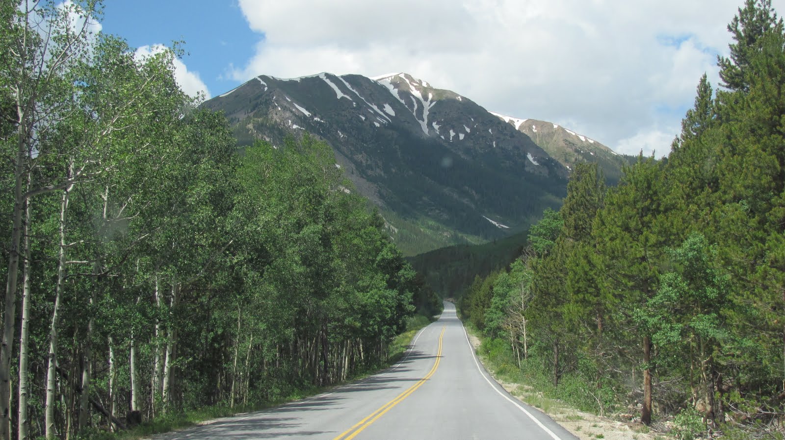
Independence Pass, elevation 12,095 ft (3,687 m), is a high mountain pass in the Rocky Mountains of central Colorado in theUnited States.
The pass is at the summit of the ridge of the Sawatch Range between Aspen and Leadville, on the border between Pitkin and Lakecounties and is located within the confines of the White River National Forest. The pass connects the upper valley of the Roaring Fork River upstream from Aspen with the headwaters of the Arkansas River near Leadville. The pass is traversed by State Highway 82 and is the second-highest paved mountain pass in Colorado after Cottonwood Pass. The top of the pass is well above the tree line and the terrain type at the top is tundra. The road is narrow and steep with a 6.5% gradient, including tight switchbacks on each approach. Sections of the pass have a speed limit of 25 mph, with advisory limits on some switchbacks as low as 10 mph. Trucks and other large vehicles are prohibited from driving on the pass; large RVs are allowed, however. The pass is always closed in winter, from the first heavy snow fall in autumn, often opening only in late May or early June
Although we stopped at the summit, we didn't take many pictures because we had been here last year.  However, this year there was much more snow on the summit. Our Jeep's outdoor thermometer indicated it was 56 degrees at the summit about a 20 degree difference from when we left BV.
We didn't go down the west side of the pass last year. So I was surprised by the very narrow and steep descent into Aspen. There were portions of the road with a cliff face on one side, drop off on another and no centerline as the road was barely narrow enough for one large vehicle.
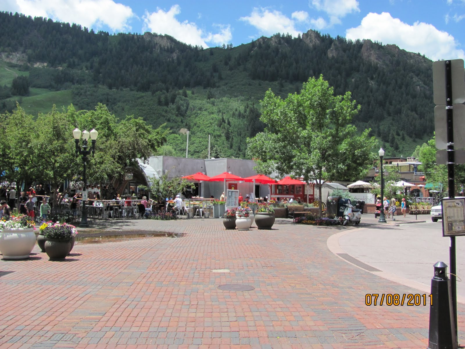
Upon arriving in Aspen we immediately noted how modern the city appeared in comparison to some of the other Colorado mountain towns we have visited. Aspen is at 7900 ft. and the temperature was 78 degrees.
Also of note was the numerous upscale shops and customers. We parked in a public parking garage as street parking was at a premium and expensive. 
We ate lunch at Little Annie's in the heart of the shopping district. Afterwards, we walked and just browsed.


Ski Lift Area in the Background
Shopping District


El Conquistador outside of the Public Library
Before long it was time to head back the way we came...over Independence Pass. We stopped at a Shell gas station with the intention of getting some fuel to make sure we had enough. When I saw the price of $4.69 a gallon, I decided we had more than enough!
Narrow curve with no lane dividers

Although we enjoyed our excursion to Aspen, we both left Aspen with the opinion that we wouldn't want to live there. It's very beautiful but, very expensive in an overindulgent kinda way if that makes any sense. I guess if we were snow skiers we would have a different perspective.
Round trip for us was about 120 miles and took a few hours. 

Friday, July 8, 2011

Travel Day to BV from Durango via Wolf Creek Pass

June 7, 2011. Durango to Buena Vista, Colorado.
We got up early and finished our moving day preparations. The night before we had a spectacular mexican dinner prepared by our 4th of July hosts, Mark and Patty. Because we had a late dinner I didn't have as much put away as I had hoped. However, we still managed to pull-out by 8:30. Durango Year Round RV Park is very tight for big rigs. So, I ended up backing out of our pull-thru site towards the exit and angled it to get out.
We had about 230 miles to travel to Buena Vista, Co. and that included a couple passes the most infamous, Wolf Creek Pass just north of Pagosa Springs.

Approaching the start of the climb to Wolf Creek Pass

Wolf Creek Pass (el. 10,857 ft.) is a high mountain pass on the Continental Divide, in the San Juan Mountains of Colorado. It is the route through which U.S. Highway 160 passes from the San Luis Valleyinto southwest Colorado on its way to New Mexico and Arizona. The pass is notable as inspiration of aC. W. McCall song. Though not as formidable as the song made it seem, the pass is significantly steep on either side (7 to 8% in most places), and can be dangerous in winter.


The climb to the pass was steep and twisting. For the majority of the climb, I kept the truck in 3rd gear and the rpms between 2200-2500 rpms. This seemed to keep the Cummins Diesel running at normal temps and maintained plenty of power. We only climbed at just over 35 mph. However, that was within the speed limit and I wasn't blocking traffic as there was a climbing lane for the majority of the climb up. In fact only a few cars were going any faster! Actually there didn't seem to be much traffic over the pass.
We stopped at the summit at the kiosk display for The Great (continental) Divide.
The Continental Divide of the Americas, or merely the Continental Gulf of Division or Great Divide, is the name given to the principal, and largelymountainoushydrological divide of the Americas that separates the watersheds that drain into the Pacific Ocean from (1) those river systems that drain into the Atlantic Ocean (including those that drain into the Gulf of Mexico and the Caribbean Sea), and (2) along the northernmost reaches of the Divide, those river systems that drain into the Arctic Ocean.
There are many other hydrological divides in the Americas, however the Great Divide is by far the most prominent of these because it tends to follow a line of high peaks along the main ranges of the Rocky Mountains and Andes, at a generally much higher elevation than the other divides.

At the Summit of Wolf Creek Pass

Traveling down from the pass is an adventure unto itself. I kept the Dodge in 3rd or sometimes 4th gear in Tow Haul Mode and the exhaust brake on (as always). The truck held the load of the trailer @ 35-40 mph down the twisty side of the mountain with an occasional use of the foot brake approaching the twisty turns. Again this was within the posted speed limits. I've heard tales of folks pulling trailers up and over the pass burning up their brakes on the way down. Today's modern diesel pickups have taken a lot of the braking concerns out of the equation.
A relatively new (2006) tunnel on the East side of the pass. 
After safely negotiating the pass, we continue east and then north towards BV. We climbed and descended Poncha Pass without incident.
Poncha Pass (9,010 ft/2,745 m) is a mountain pass in South-Central Colorado (USA). It lies between the San Luis Valley to the south and the valley of the Arkansas River to the north, and is one of the lowest mountain passes in the state [1]. It is in the saddle between the Sangre de Cristo Range, lying to the southeast, and the Sawatch Range, lying to the west and northwest. US Highway 285 runs over the pass, linking the towns of Alamosa to the south and Salida to the northeast. The small town of Poncha Springs lies about 6 miles (9 km) north of the pass. The pass has a mild approach on the northern side and a moderate 5% approach from the south, though it remains open all year round and does not normally cause problems for vehicles in winter.
Descending from Poncha Pass
We stopped for a quick bite to eat and a break in Poncha Springs. We could see storm clouds ahead of us to the north. After about 6 hours on the road and some light showers we pulled into Valley RV Park aka Mobile Valley RV Park. We had stayed in this park last year.
We were assigned site 29, perhaps the largest site in the park. A nice corner pull through site.
We got set-up and took these pictures just minutes before it rained. The first good rain that we have seen in months.
View out the door side.
In fact, it rained again overnight! Gotta love Colorado!
We had a good uneventful travel day and I seemed to be getting good mileage out of the truck at over 10 mpg. Very acceptable considering the long climbs pulling a 15K+ fifth wheel.