Lake Mead N.R.A.

Lake Mead N.R.A.
READY TO ROLL!

Sunday, January 9, 2011

Visiting with Friends from our New Life Style

January 9, 2011 Usery Mountain Regional Park.

Another Beautiful Sunset
Yesterday, we invited some friends Betty and Dale to come visit with us. We had met Betty and Dale last spring at Cottonwood Creek RV Park. We had made an instant connection and enjoyed their company. They are staying in a RV park in Goodyear on the west side of Phoenix. They RV in the winter months to escape the winter weather of the Midwest. Betty and Dale arrived around noon and after catching up we enjoyed a wonderful lunch of chili with chicken sandwiches. Betty brought a wonderful lemon pie. 
We took a short hike around the park showing off it's many varieties of cactus and the wonderful scenic vistas. Later we took a ride in the Jeep out towards the Superstition Mountains.  We took them down the dirt road to the First Water Trail Head, where we had previously done a hike. At the trail head we discovered the Maricopa County Sheriff's Office (MCSO) had a Search and Rescue Party that was apparently wrapping up their operation. I captured this picture of their helo taking off.
Today we learned that they had found the remains of lost hikers/ explorers. Ironically from the same area where we had nearly become lost.

MCSO Finds Remains of 2 People

Updated: Saturday, 08 Jan 2011, 5:27 PM MST
Published : Saturday, 08 Jan 2011, 4:31 PM MST
MESA - The Maricopa County Sherriff’s Office has found remains they believe are from two people in the Superstition Mountains Saturday afternoon.
The MCSO mountain rescue team and helicopter spent most of Saturday searching for the remains that were found by a man hiking on Friday night.
The man told MCSO that he thought they might belong to the three hikers from Utah who went missing in July, according to MCSO spokesman Jeff Sprong.
Sprong said officials will be checking to see if they are the remains of two of the hikers.
He said because of the conditions of the remains, the Medical Examiners Office will be trying to identify them. It was unknown how long it will take to identify the subjects.
Related Story:
Sheriff Ends Search for Missing Utah Hikers

After witnessing the activity at the trail head, we took a ride and stopped along the way to take photos of the Superstition Mountains.
Dale, Betty and Joyce
We really enjoyed visiting with Dale and Betty and we sure hope to see them again sometime down the road. Who knows, maybe someday we will stop and visit them on their farm in Nebraska.
Today, we took a ride with my Father and Karen out to the Gold Canyon community to meet some of their friends and have lunch at the country club. We had a great time and enjoyed seeing the area and the company.


Friday, January 7, 2011

Our new site at Usery Mtn. Regional Park and a short hike.

January 7th, 2010 Usery Mountain Regional Park.
House Finch feasting on a half orange
As you know, we had to move sites per the park's rules after the initial 14 days in one site. So on the 4th we moved from site 9 to site 30. It's on the outer loop but an inside site with a great rear view of Pass Mountain.
Site 30
Side yard with fire pit.
Rear window view.

After our last dramatic hike where we felt a bit lost, I did some thinking about what kind of gear we should carry with us. So the next day at Walmart we picked up a first aid kit, some portable foil emergency blankets, plastic ponchos and a waterproof match stick holder. Back at home I packed both our packs with the above gear including a small flashlight for each and a pair of leather work gloves. In my pack I also packed a small wool blanket extra batteries and fire starter. I've basically determined that my pack may be too small with the added gear for hiking in the desolate backcountry mountains. 
I also purchased a Bushnell Original Back Track from Sam's Club. 


GPS MADE SIMPLE!

BackTrack utilizes GPS technology in its most basic format, BackTrack has only two buttons and stores up to three locations – just mark it and forget it until it’s time to return. At the end of the day, select your location and the BackTrack displays direction and distance to travel. Use it to find your car in a crowded parking lot, your treestand or the trailhead, even to rendezvous with your group. It’s extremely compact and stows conveniently in your pocket, pack or purse.

It's a very simple GPS that can mark up to three locations at a time i.e. you car. The Back Track then gives you a directional arrow and distance (as a bird flies) to your car or whatever location you set into the Back Track. At $39 it was certainly cheaper and less complicated than a full scale portable GPS.
I did a short hike today down to the Salt River in the Tonto National Forest to test the Back Track.
The Bushnell Back Track so far works as advertised. I obtained a satellite signal after getting out and set the Back Track to the location of my vehicle. The unit powers off after a short period of inactivity. When you turn it back on it immediately obtains a satellite signal and picks up in the mode from which it turned off. It measures the distance initially in yards and then eventually in miles and tenths of a mile. Right now I'm very satisfied with it. 

Monday, January 3, 2011

Hike at First Water Trail Head in the Superstition Mountains

January 3, 2011 Usery Mountain Regional Park.
You may have noticed that we started a Facebook page for our blog. I'll be posting more pictures on the Facebook site as it's faster to load them. In addition there will be more timely short updates. Joyce will be helping me with monitoring the Facebook page. Please feel free to write on the wall. In the near future perhaps we will have some "Discussions" on the Facebook page as I become more familiar with it.
Well, today we were supposed to move campsites to be in compliance with the park's 14 day rule. We found a site we wanted and went to the gate house to register. Their information indicated the site would be vacated by noon so we paid for a week at the site.  So at some point we drove by the site to check on the status of the occupants to see if they were preparing to move. It turns out they had a new tag posted on their site indicating they wouldn't be leaving till 1-4-11.  Long story short, they had renewed via the "iron ranger" and after checking back with the registration desk we ended up staying in our current site at least till tomorrow. The volunteers running the registration desk were very apologetic for the mix-up. So tomorrow morning we will pull out to dump our tanks and move to another site.
So, with the morning shot, we decided to take an afternoon hike in the Superstition Mountains. We drove east through Apache Junction before turning Northeast on Hwy. 88. turning at a sign for First Water Trail Head on FR-78.

The turn onto FR-78 to the First Water Trailhead in the Superstition Mountain Wilderness is 0.3 miles past Lost Dutchman State Park on the Apache Trail (SR-88). FR-78 is a gravel road with several unbridged crossings but it's almost always passable by passenger cars. The exception would be during or after a rain. This is one of the two most popular trailheads in the Superstition Wilderness--the other being the Peralta Trailhead. The main trails leaving the trailhead are the Dutchman Trail and the Second Water Trail.
In addition to the trails out of the First Water Trailhead, this road is also used for access to: the Crosscut Trail, the Massacre Falls Trail, the First Water Horse Lot (Overflow lot), Hackberry Spring, and First Water Ranch. There are vault toilets at the First Water Trailhead and at the First Water Horse Lot


Near the end of the FR-78 (dirt road) is the trail head.
Starting out on the Lost Dutchman Trail.


The trails were not very well marked and we didn't see any maps of the area at the trail head. By this point below, we were pretty much lost!
I had a compass and a general heading for the start of the trail head but that's it. And the general heading was over hill, mesa, stream and mountain. Not exactly a direct route.
It was just after 3:00 so I knew we had a couple hours of daylight. However the low sun and the clouds made it seem later in the day.


We decided to continue moving forward following a trail. A trail that seemed at times to be frequented by equestrians as evidenced by the occasional pile of horse manure.
We seemed to pass over the same or similar creek beds along the trail as we were becoming increasingly uneasy about our apparent inability to find our way! Finally we saw what looked like a hut in the distance. We hiked toward it and what we thought was a hut was a tin roof covered stable. Thankfully there was a man and woman there who helped us with directions back to the trail head. 
Covered Horse Stable
It turns out we had been within a couple miles of the trail head and once out of the valley they called "Second Water Valley". We were back on the dirt road FR-78 and had only a short hike to the end of the road and the trail head. We got back just short of 3 hours.
Back home, I did some "Google" searches and found this very good site of the trails: Hike Arizona. Best I could tell we did a version of the Hack Berry Spring Loop. 
This hike has made us realize that really should carry a GPS or some type of directional finder other than a compass. It's rare that we ever have a map of the areas we hike. We took off on this trail cold without any information before hand. Perhaps not the best way to go!
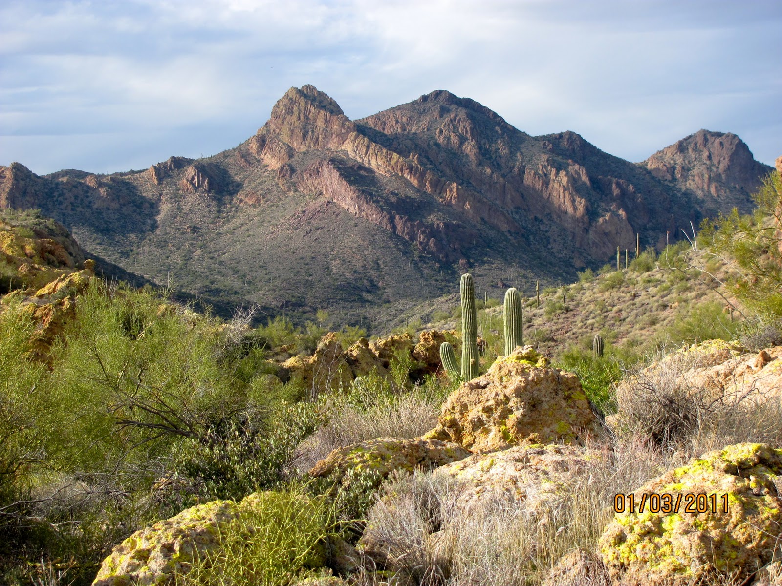
Having said all that, It was a beautiful hike with lots of beautiful mountain scenery.