Lake Mead N.R.A.

Lake Mead N.R.A.
READY TO ROLL!
Showing posts with label Carlsbad. Show all posts

Friday, April 23, 2010

Sitting Bull Falls


April 22, 2010.
We awoke to a beautiful day with brisk morning temps. The temperature quickly rose along with the sun although it only reached the middle 70's. 

We had seen a sign near the entrance of our park, Brantley Lake State Park for Sitting Bull Falls - 32miles southwest.  We decided to explore and try and find it.  We took off in the direction indicated by the sign on NM Hwy. 137. 


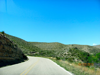
We were soon into the Guadalupe Mountains enjoying the twisting winding roads.


Shortly after entering the Lincoln National Forest, we came across the small parking lot at the dead end of Sitting Bull Drive. The picnic shelters were like small stone buildings minus the windows and doors. A group of kids and their school buses were all over the parking lot and the park. 


Joyce and I took the concrete sidewalk out to the falls after paying the $5 day use fee. We weren't really dressed appropriately as the wind was blowing and it was much cooler in the mountains.


Sitting Bull Falls
The water of the 130-foot falls is highly mineralized and has deposited a massive travertine bluff that towers over the picnic ground. The size of the travertine deposit indicates that the falls may have been much bigger in times past. Special attractions: One of the largest waterfalls in New Mexico. There is a cave system hidden behind the falls. The cave is accessible only by appointment and requires park ranger guide. The trail up to the cave is dangerous and therefore is off limits without permission.


From what I read on signs in the park, the water comes out of the ground in the mountains and runs down creating the falls. Although tall, there certainly wasn't a lot of water pouring over the top. Classes were being conducted for the kids at the bottom of the falls.


We all like kids, but I sure don't like going to what you expect would be a nice peaceful part of nature only to find kids all over the place and adults and kids yelling at the top of their lungs!  Kinda ruins the experience.


We spent about 30 minutes at the falls and headed back.  Actually we went into Carlsbad and checked out the small mall.


Back home at Brantley Lake State Park the winds had really picked up. There was a high wind advisory. The forecast was for a high wind warning tomorrow with gusts up to 60 mph and 30-45 mph sustained winds. Not good considering the fact that the great views we had on the top of the ridge, meant we were really exposed to the winds. We had planned to leave tomorrow but were concerned about traveling in the winds. We would have to make a decision in the morning. 


Thursday, April 22, 2010

Carlsbad Caverns

April 21, 2010.
The weather was beautiful with lows overnight in the mid 50's. We were up early and took Maggie and Rico for a long walk around Brantley Lake State Park, NM. We checked out the boat ramp and walked one of the trails. However, this blog is about Carlsbad Caverns! So fair warning, there's a fair number of photos!

We were out the door and on our 47 mile journey to Carlsbad Caverns by 10:00.  Surprisingly the start of the road into the caverns is in White City.  Carlsbad Caverns is part of the Guadalupe Mountains National Parks.


The road into the caverns travels through beautiful gorges and climbs up to over 4000 ft.


The National Park Service building for the Caverns sits on top of the hill / mountain.


We had our choice of taking the elevator down 750 ft to the Main Room or hiking in from the natural entrance. We were told that hiking in may take an additional 1-1.5 hrs. We were concerned about being away from the dogs for too long, so we took the elevator down. You are not permitted to take food, gum or beverages other than water into the cavern. You also cannot use hiking sticks and of course, you can't touch the formations.  I took about 196 pictures but only posted a few.


History of Carlsbad Cavern National Park
More than 1,000 years ago prehistoric Native Americans ventured into Carlsbad Cavern seeking shelter. They left behind no record of what their impressions of the cave were, but they did leave some mysterious drawings on cave walls near the natural entrance. Much later, in the 1800s, settlers discovered the cavern, drawn to it by the spectacle of hundreds of thousands of bats rising up out of the natural entrance in the evening. Some stayed to mine the hugh deposits of bat guano in the cave and sell it as a natural fertilizer. One such man, a cowboy named Jim White, became fascinated by the cave and spent hour after hour exploring it. White was eager to show the many natural wonders of this extraordinary place to others, but few persons believed his improbable tales of a huge underground wilderness full of unusual cave formations. It took photographs to convince skeptics that Carlsbad Caverns was everything it was said to be and more.


Black and white pictures taken by Ray V. Davis, who accompanied White on a cave trip, were displayed in the town of Carlsbad in 1915. They created a sensation. People suddenly clamored to see the marvelous cave for themselves. White took them on tours that began with an unceremonious 170 foot descent in a bucket once used to haul bat guano from the cave.

Word of the cave spread, finally reaching Washington, D.C. Again, there were nonbelievers, but in 1923 the U.S. Department of the Interior sent inspectors Robert Holley to investigate and see whether Carlsbad Cavern was truly an outstanding natural scenic wonder. Originally a skeptic, Holly wrote in his final report: "...I am wholly conscious of the feebleness of my efforts to convey in the deep conflicting emotions, the feeling of fear and awe, and the desire for an inspired understanding of the Devine Creator's work which presents to the human eye such a complex aggregate of natural wonders...."


Later that year Carlsbad Cavern was proclaimed a national monument. White, who was to continue his cave explorations for most of his lifetime, became its first chief ranger. Seven years later Carlsbad Caverns National Park was created to protect the cave. Through illustrated articles published in magazines such as National Geographic and by word of mouth, Carlsbad Cavern became one of the world's most celebrated caves. Since its establishment, the park has been expanded and today includes 46,766 acres and more than 80 other smaller caves.


The cavern is very dimly lit with some back lighting on the prominent features. I had seen pictures of the caverns and was surprised that it was so dark as the pictures I had seem made it appear well lit. To be honest, my pictures were dark, I used the enhancement feature on my Mac computer to bring the pictures to light. 

After completing the self-guided 1.25 mile hike in the Big Room, we took the elevator back up to the main building. We wanted to see the bat amphitheater and the natural entrance so we hiked to the natural entrance of the caverns.

The Mexican Free Tail Bat inhabits the entrance to the cavern and is famous for their bat flight out of the caverns in the evening. However, we were told the bats have yet to return to the caverns from Mexico so there isn't a bat flight exhibit scheduled till they return. Below is the amphitheater for the bat flights.


We walked down the steep descent to the natural entrance and enjoyed the view.


As you can see in the photo the hike down is a series of switch backs. 


The hike back up from the natural entrance was steep!  When you hike into the cave through the natural entrance, you are required to take the elevator in the Main Room back to the top. The park ranger posted near the entrance took our photo. 


We enjoyed our visit and after a few hours made it back to our car parked on the top of the mountain/ hill over looking the valley below.  Our entrance fee ($6 each) was free this week as are all the entrance fees to National Parks this week.


Back home we grilled out and watched a thunderstorm roll in after dark. We got some rain that lasted only a few minutes, but the view from our ridge was spectacular!

Tuesday, April 20, 2010

Travel Day to Brantley Lake State Park Carlsbad, New Mexico

April 20, 2010.
We slept well overnight and got up about 8:00. We were anxious to get out of Parkview Rv Park in Stockton, Tx. Today we planned to travel to Carlsbad, NM


View Larger Map


We were not impressed with what little we saw of Fort Stockton and Pecos Tx. We had to drive through both towns on Hwy 285 as we headed north and west towards New Mexico. The landscape in this part of Texas is rather flat and sparsely vegetated. Hwy 285 N. is a two lane well worn road with sparse traffic. Ironically we were passed twice by a Ford truck pulling a Carriage Carri-Lite at about 70 mph.


The road seemed to be smoother once we crossed into New Mexico. We were now at an elevation of over 3100 ft. known as the Chihuahuan Desert.This high desert, the largest desert in North America covering more than 200,000 square miles -- lies south of the international border. In the U.S. it extends into parts of New Mexico, Texas and sections of southeastern Arizona. Its minimum elevation is above 1,000 feet, but the vast majority of this desert lies at elevations between 3,500 and 5,000 feet.

After about 168 miles and a stop at Walmart in Carlsbad, we made it to Brantley Lake State Park. On the route, I cruised in overdrive at 1700 rpms @ 61 mph and got over 10 mpg. 


Brantley Lake State Park is located in the Chihuahuan Desert region of southeastern New Mexico. It's about 15 miles north of the city of Carlsbad, NM. It's also the closest state park to Carlsbad Caverns and we plan to visit the caverns during our stay. The Caverns are about 47 miles away. 

We checked into the visitor center and registered for a campsite.  Our 30 amp and water campsite is $14 per night plus $10 for Joyce's car. However, the ranger agreed to charge us just $8 per day for Joyce's car, the price of a primitive campsite. We paid for 3 nights.


The weather was beautiful on our arrival, and I was very impressed with our site high on a ridge overlooking the desert and Lake Brantley.


We are in site 38 in the South loop which is first come first serve non-reserveable. The larger North loop has reservation sites. You all know how I feel about reservations! Throughout the park, I noted that there are only a few sites that would support large rigs. We were lucky to get one of them.


There is a lot of space between the sites. Also a nice sheltered metal picnic table. Our site from below the ridge.


Our view out the rear window or our fifth wheel travel home.


Out the front of our rig and across our camp ground loop, you can see the dam on Lake Brantley.