Lake Mead N.R.A.

Lake Mead N.R.A.
READY TO ROLL!

Thursday, April 29, 2010

High Wind Advisory and Warnings

April 28-29, 2010


We stayed at home the last couple of days except for a short excursion into Alamogordo for ice cream. We have sort of been prisoners to the weather. We've experienced a very strong wind storm over the last couple of days with steady winds at 30-45 and gusts from 50-60 mph. Yesterday we were under a High Wind Advisory. 


It has been so dusty that we can't see the mountains and visibility in general is limited. Dust seems to get everywhere and on everything. Today the weather service issued a High Wind Warning until 9 p.m. A High Wind Warning is a warning for sustained surface winds greater than 40 mph/64 kph lasting more than an hour or winds over 58 mph/93 kph over land that are either predicted or occurring for an unspecified period of time.


Our dusty view out the back window. Before the wind storm we could see the Sacramento Mountains and Sierra Blanca.


I worked on updating our Campground Review page and Our Rig and Upgrades page and returned some e-mails.  Maggie and Rico chilled inside with us.


We plan to move on to Silver City, NM a small town north of Deming NM. Of course that will depend on the weather! We are hoping to watch a portion of the Tour of the Gila. Lance Armstrong is participating in the race once again this year. If we like the area, we will plan on staying for a month.

Tuesday, April 27, 2010

White Sands National Park

April 26, 2010.
It was another beautiful day in Almogordo and the Tularosa Basin. The temps overnight were in the 50's with an expected high in the lower 80's.


Today we visited White Sands National Park about 22 miles from our RV park, Boot Hill RV Resort.  The ride out on Hwy 70 was easy. Hwy 70 is often closed when the military conducts tests at White Sands Missle Range. A closure was scheduled today for an hour beginning at 12:10. However, the closure would not affect us entering or leaving the park. Along the way we passed Holloman Air Force Base and could see the FamCamp from the road. 


Before long we were arriving at the national park.


There is ample parking for cars and the lot will also handle RVs. However, there is no RV camping at the park.


The beautiful adobe welcome center and offices were built in the 30's. Inside the welcome center, we watched a short video about White Sands, the movement of the dunes and the plant and animal life. There's also a couple of gift shops in the building.


We planned to do a "self guided tour" along the 8-mile stretch of road in the park. So after leaving the welcome center we drove about a 1/8 mile to the ranger station to pay the $3 per person admission fee.


The drive started out looking like sand interspersed with shrubs and typical vegetation in this part of the desert.


The drive soon turned to nearly solid gypsum sand. It looked a lot like some of the beach areas along the gulf coast. However, the beaches are comprised of quartz sand.


The largest pure gypsum dune field in the world is located at White Sands National Monument in south-central New Mexico. This region of glistening white dunes is in the northern end of the Chihuahuan Desert within an "internally drained valley" called the Tularosa Basin. The monument ranges in elevation from 3890' to 4116' above sea level. There are approximately 275 total square miles of dune fields here, with 115 square miles (about 40%) located within White Sands National Monument. The remainder is on military land that is not open to the public. This dune field is very dynamic, with the most active dunes moving to the northeast at a rate of up to 30 feet per year, while the more stable areas of sand move very little. The pure gypsum (hydrous calcium sulfate) that forms these unusual dunes originates in the western portion of the monument from an ephemeral lake or playa with a very high mineral content. As the water evaporates (theoretically as much as 80" per year!), the minerals are left behind to form gypsum deposits that eventually are wind-transported to form these white sand dunes. Many species of plants and animals have developed very specialized means of surviving in this area of cold winters, hot summers, with very little surface water and highly mineralized ground water (click on the Animal or Plant links to the right for more information). For a general overview of the geology of the Tularosa Basin and White Sands National Monument, click on "Related Links".

Joyce and I parked the car and decided to try out the two sleds we borrowed from Boot Hill RV Resort. So we climbed the nearest tall dune and I captured this photo with the snow covered Sierra Blanca Peak in the distance.


Joyce was barefoot and out of the car headed for the dunes before I was able to get my shoes off! I caught her first attempt at sliding.


It's not as easy as it looks. You need to find a really steep dune and wax the bottom of the sled. Even so, I tended to just plow into the sand.


Looking for a taller steeper dune.


Before long we had enough. We decided that sledding was better suited for kids, possibly because they are smaller and lighter. Yea we were kids once!


We completed our drive through the park. I thought these picnic tables were kinda unusual. I sure wouldn't want to visit here in the middle of the day during summer!


We had a great time at the park.  We enjoyed exploring and experiencing the natural beauty of White Sands National Park

Afterwards, we went into Alamogordo to do some shopping. After we got back, a nice couple, Phil and Stephanie from Alto, NM. pulled up and explained that they have a Carriage Cameo. They were inquiring about the tires that we have on our rig. I showed them our Goodyear G614s. They said they recently experienced a blow-out with a Duro Tire and it damaged their rig. We chatted for awhile before they had to go home. We enjoyed their company and sharing experiences. We wish them well on their planned trip to Alaska this year. 

Sunday, April 25, 2010

Ruidoso, NM, Inn of the Mountain Gods, McGinn's Pistachio Ranch

April 25, 2010.
We woke to a beautiful cloud free day with morning temps in the 40's. However, with the bright sun, it quickly warmed to low 80's. We decided to take a drive out to Ruidoso in the Sacramento Mountains. We wanted to check out the town and some of the campgrounds. So, we took off in the car, but I forgot the maps. I drove back to our site when I noticed this beautiful shot of the mountains behind our rig looking north.


As we drove the 41 miles north we got even closer to Sierra Blanca.
Few peaks match the awesome grandeur of Sierra Blanca. At just below 12,000 feet in elevation, Sierra Blanca looms intimidatingly large from the sandy deserts and rangelands that surround the compact range. From some vantage points there is nearly 8,000 feet of elevation differential bewteen the viewer and the summit. Its snow-capped summit is visible well into the summer, from the sizzling deserts below.

Sierra Blanca has many superlatives: it is the highest mountain in southern New Mexico and the highest 'southern' mountain in the mainland USA (i.e. any higher US peaks are north of Sierra Blanca's latitude, and the next higher peaks south are in Mexico). It also has the highest prominence in New Mexico at over 5,000 feet above its defining saddle.

We climbed to over 7900 ft. as we drove thru Mescalero the Apache Pass and the Apache Reservation on our way to Ruidoso.


Once we made it to Ruidoso, we drove around admiring the quaint little mountain town. All that driving gave us an appetite so we stopped at this little local spot for some tacos and tostadas. We had a great lunch!


While looking for a campground, the GPS got us lost and we ended up on top of a mountain amidst a very upscale housing development. Anyway the views from the development were spectacular.


On the way back to Alamogordo we stopped at Inn of the Mountain Gods a hotel and casino on the Apache Reservation


When you first enter the hotel you can see all the way through to this gorgeous view.


The Mescalero Apaches own and operate the Inn of the Mountain Gods Resort, which offers first-rate golf with a course rate 35th best in the nation by Golf Week Magazine, (575) 464-5141. The resort also operates the Casino Apache and Ina Da Card Room for those who like to partake in Las Vegas-style gambling; (575) 464-4100, (877) 277-5677. The Inn also hosts concerts by nationally known recording acts.

Below is the beautiful staircase around the fountain in the casino.We didn't come to gamble but just to check out the scenery as it had been recommended by the owners of the park that we are staying at.


Continuing on the Hwy. 70 south towards Alamogordo, we could see White Sands in the distance. It's also visible from our campsite!


Before, going home we stopped at McGinn's Pistachio Tree Ranch nearly across the street from the park we are staying at, Boot Hill RV Resort.


The small shop offered free samples of flavored pistachios. We tried several flavors and settled on a package of pistachios flavored with green and red chillies. They also raise pecans, grapes and have a winery.


We walked through the rows of pistachio trees and the rows of


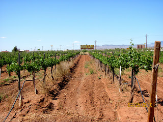
grape vines. This area is renowned for its pecan and pistachio groves and grape vineyards.


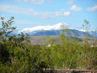
Back home we relaxed and enjoyed the view of Sierra Blanca as we had done the day before. Yesterday we stayed home, relaxed and tried to clean up the rig, truck and car from the slushy snow mess we encountered on the trip out here through the mountains. 


Friday, April 23, 2010

Travel Day to Alamogordo, NM and Wacky Weather

April 23, 2010
I woke up at 6 am and noticed the wind from last night had subsided. Gusts were 35-45 mph with sustained 30 mph overnight. The forecast for today included a High Wind Warning with the worst of it in the afternoon. I figured we needed to make a break for it while we still could!


After packing and hitching up we headed for the dump station. We were on the road by 8:30.  By now the winds were already picking up from the south and west. I could feel the winds pushing the trailer. 


We headed north on 285 to Artesia and then turned west on Hwy. 82. Immediately I began seeing signs warning of high elevations and steep 6% descents. The signs restricted trucks over 62 feet and those without engine braking. I sure couldn't see any mountains up ahead. I was getting pummeled by the increasing winds I drove @ 51 mph due to the wind. It was blowing at least 30 mph hitting me with a cross wind and head wind.


As we continued west the high desert changed to juniper forests. I noticed a few vehicles heading in the opposite direction with 3-4 inches of snow on them. My initial thought was that they were coming from someplace that we were not going!


As we continued to climb, the temperature outside was dropping and before long we saw snow on the side of the road.


We continued to gain altitude and the snow flakes began falling faster and thicker.


It continued to snow and the roads were wet and slushy.


The conditions got much worse as we rose over 9000 ft. By this point, I was really concentrating on controlling the rig on the slushy wet roads and I was fearful of ice. Temps were in the 20's. We saw snow plows passing in the opposite directions. The snow and slushy road conditions really got my attention as we began to descend with the 6% grades and several switchbacks. Truck speed limits were 30-35 mph with the ever re-assuring run-away lanes every few miles.


However, I was actually impressed with my truck and its ability to handle the descent. The exhaust brake and transmission worked as advertised. I locked the transmission in Tow Haul Mode and 3 or 4th gear on the way down the mountain. With my foot off the brake it would hold the rig at 30-35 mph and I would actually have to accelerate in some spots as it would slow down too much. Before long we were out of the snow and back into the sunshine coming down the Sacramento Mountains.


After several hours (around noon) we arrived at our destination Boothill RV Resort. Before parking we needed to wash off the rig as it was filthy from the snow, slush, salt and sand. So we went into Alamogordo to find a truck wash. We found the truck wash recommended by the park owner and cleaned up the rig as best we could. Unfortunately after returning, we learned that a RV had flipped (presumedly from the wind) just a few miles north of Brantley Lake State Park along our route.


Now a resort it's not! But it is a nice clean RV park. It's kinda like a gravel parking lot with RV hook-ups which is not unlike most of the parks in this region of the country. We are in site 410 with a beautiful view of the mountains out our back window.


Since getting parked and set up, the weather has been fickle. We've seen hail, sleet, rain drops wind and bright sun! However, we should have beautiful weather the rest of the week. We plan to stay here for a week and visit White Sands and other attractions in the area.


Below is a snow capped mountain seen outside our front door during a sunny moment!


It was certainly a busy but exciting day. We certainly didn't expect to travel through the high mountains today and we certainly weren't expecting snow. I still love travel days!

Sitting Bull Falls


April 22, 2010.
We awoke to a beautiful day with brisk morning temps. The temperature quickly rose along with the sun although it only reached the middle 70's. 

We had seen a sign near the entrance of our park, Brantley Lake State Park for Sitting Bull Falls - 32miles southwest.  We decided to explore and try and find it.  We took off in the direction indicated by the sign on NM Hwy. 137. 


We were soon into the Guadalupe Mountains enjoying the twisting winding roads.


Shortly after entering the Lincoln National Forest, we came across the small parking lot at the dead end of Sitting Bull Drive. The picnic shelters were like small stone buildings minus the windows and doors. A group of kids and their school buses were all over the parking lot and the park. 


Joyce and I took the concrete sidewalk out to the falls after paying the $5 day use fee. We weren't really dressed appropriately as the wind was blowing and it was much cooler in the mountains.


Sitting Bull Falls
The water of the 130-foot falls is highly mineralized and has deposited a massive travertine bluff that towers over the picnic ground. The size of the travertine deposit indicates that the falls may have been much bigger in times past. Special attractions: One of the largest waterfalls in New Mexico. There is a cave system hidden behind the falls. The cave is accessible only by appointment and requires park ranger guide. The trail up to the cave is dangerous and therefore is off limits without permission.


From what I read on signs in the park, the water comes out of the ground in the mountains and runs down creating the falls. Although tall, there certainly wasn't a lot of water pouring over the top. Classes were being conducted for the kids at the bottom of the falls.


We all like kids, but I sure don't like going to what you expect would be a nice peaceful part of nature only to find kids all over the place and adults and kids yelling at the top of their lungs!  Kinda ruins the experience.


We spent about 30 minutes at the falls and headed back.  Actually we went into Carlsbad and checked out the small mall.


Back home at Brantley Lake State Park the winds had really picked up. There was a high wind advisory. The forecast was for a high wind warning tomorrow with gusts up to 60 mph and 30-45 mph sustained winds. Not good considering the fact that the great views we had on the top of the ridge, meant we were really exposed to the winds. We had planned to leave tomorrow but were concerned about traveling in the winds. We would have to make a decision in the morning. 


Thursday, April 22, 2010

Carlsbad Caverns

April 21, 2010.
The weather was beautiful with lows overnight in the mid 50's. We were up early and took Maggie and Rico for a long walk around Brantley Lake State Park, NM. We checked out the boat ramp and walked one of the trails. However, this blog is about Carlsbad Caverns! So fair warning, there's a fair number of photos!

We were out the door and on our 47 mile journey to Carlsbad Caverns by 10:00.  Surprisingly the start of the road into the caverns is in White City.  Carlsbad Caverns is part of the Guadalupe Mountains National Parks.


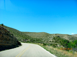
The road into the caverns travels through beautiful gorges and climbs up to over 4000 ft.


The National Park Service building for the Caverns sits on top of the hill / mountain.


We had our choice of taking the elevator down 750 ft to the Main Room or hiking in from the natural entrance. We were told that hiking in may take an additional 1-1.5 hrs. We were concerned about being away from the dogs for too long, so we took the elevator down. You are not permitted to take food, gum or beverages other than water into the cavern. You also cannot use hiking sticks and of course, you can't touch the formations.  I took about 196 pictures but only posted a few.


History of Carlsbad Cavern National Park
More than 1,000 years ago prehistoric Native Americans ventured into Carlsbad Cavern seeking shelter. They left behind no record of what their impressions of the cave were, but they did leave some mysterious drawings on cave walls near the natural entrance. Much later, in the 1800s, settlers discovered the cavern, drawn to it by the spectacle of hundreds of thousands of bats rising up out of the natural entrance in the evening. Some stayed to mine the hugh deposits of bat guano in the cave and sell it as a natural fertilizer. One such man, a cowboy named Jim White, became fascinated by the cave and spent hour after hour exploring it. White was eager to show the many natural wonders of this extraordinary place to others, but few persons believed his improbable tales of a huge underground wilderness full of unusual cave formations. It took photographs to convince skeptics that Carlsbad Caverns was everything it was said to be and more.


Black and white pictures taken by Ray V. Davis, who accompanied White on a cave trip, were displayed in the town of Carlsbad in 1915. They created a sensation. People suddenly clamored to see the marvelous cave for themselves. White took them on tours that began with an unceremonious 170 foot descent in a bucket once used to haul bat guano from the cave.

Word of the cave spread, finally reaching Washington, D.C. Again, there were nonbelievers, but in 1923 the U.S. Department of the Interior sent inspectors Robert Holley to investigate and see whether Carlsbad Cavern was truly an outstanding natural scenic wonder. Originally a skeptic, Holly wrote in his final report: "...I am wholly conscious of the feebleness of my efforts to convey in the deep conflicting emotions, the feeling of fear and awe, and the desire for an inspired understanding of the Devine Creator's work which presents to the human eye such a complex aggregate of natural wonders...."


Later that year Carlsbad Cavern was proclaimed a national monument. White, who was to continue his cave explorations for most of his lifetime, became its first chief ranger. Seven years later Carlsbad Caverns National Park was created to protect the cave. Through illustrated articles published in magazines such as National Geographic and by word of mouth, Carlsbad Cavern became one of the world's most celebrated caves. Since its establishment, the park has been expanded and today includes 46,766 acres and more than 80 other smaller caves.


The cavern is very dimly lit with some back lighting on the prominent features. I had seen pictures of the caverns and was surprised that it was so dark as the pictures I had seem made it appear well lit. To be honest, my pictures were dark, I used the enhancement feature on my Mac computer to bring the pictures to light. 

After completing the self-guided 1.25 mile hike in the Big Room, we took the elevator back up to the main building. We wanted to see the bat amphitheater and the natural entrance so we hiked to the natural entrance of the caverns.

The Mexican Free Tail Bat inhabits the entrance to the cavern and is famous for their bat flight out of the caverns in the evening. However, we were told the bats have yet to return to the caverns from Mexico so there isn't a bat flight exhibit scheduled till they return. Below is the amphitheater for the bat flights.


We walked down the steep descent to the natural entrance and enjoyed the view.


As you can see in the photo the hike down is a series of switch backs. 


The hike back up from the natural entrance was steep!  When you hike into the cave through the natural entrance, you are required to take the elevator in the Main Room back to the top. The park ranger posted near the entrance took our photo. 


We enjoyed our visit and after a few hours made it back to our car parked on the top of the mountain/ hill over looking the valley below.  Our entrance fee ($6 each) was free this week as are all the entrance fees to National Parks this week.


Back home we grilled out and watched a thunderstorm roll in after dark. We got some rain that lasted only a few minutes, but the view from our ridge was spectacular!