Lake Mead N.R.A.

Lake Mead N.R.A.
READY TO ROLL!
Showing posts with label Oregon. Show all posts

Tuesday, October 18, 2011

Crater Lake National Park and Collier Memorial State Park


October 15-16, Collier Memorial State Park Chiloquin, Oregon.
We got a late start on our travel day to Collier Memorial State Park from Casey's Riverside RV Park. However, we only had just over 100 miles to travel. 
Once on the road we continued to enjoy the fall forest colors and the good relatively smooth roads. We did however unexpectedly climb over a small 5K foot pass.
Willamette Pass (5,128 ft/1,563 m) is a mountain pass crossing the crest of the Cascade Range in the U.S. state of Oregon. The pass is traversed by Oregon Route 58. The Willamette Pass Resort ski area is located at the pass.


Our destination today was Collier Memorial State Park in Chiloquin, Oregon. This area of Oregon is relatively undeveloped and we later discovered groceries and fuel were hard to find. However, it would serve as a good base camp for a trip to Crater Lake N.P.
Upon arrival at the state park, we picked our own site and self-registered. The sites are first come first serve and in this off-season only $17 for full hook-ups including 50 amps. However, with our "extra vehicle" we had to pay an additional $5. Again, I don't think it's right to be charged more if it fits on our site. But, it is what it is. We took site B4 and Paul and Paula took B6.


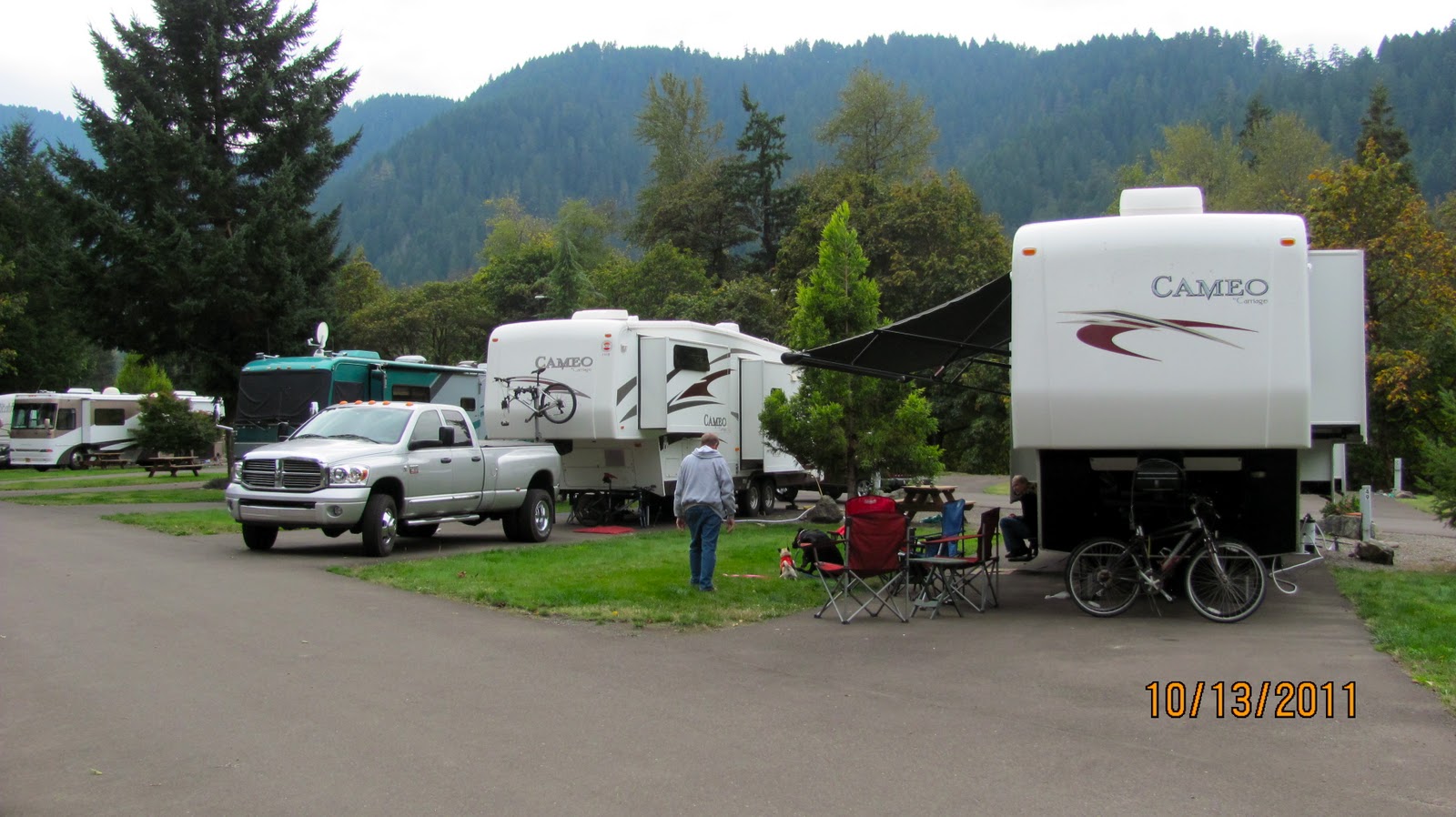
We chose these two sites because we had a clear shot over the river in the back of us to the South sky for our satellite dish. There is no digital over the air television reception. All the sites are paved and back-ins with the exception of the curved pull-throughs like the one below.


We arrived on a Saturday so the park was busier than we expected for this late in the season. We were perhaps the longest rigs in the park and I had some difficulty maneuvering into my spot due to the proximity of the trees. The weather was fabulous and for a while I was tempted to put on shorts but, that quickly faded along with the sun. Paul and I explored on bikes the trail along the river behind our rigs and the logging camp museum on the park property. 

The next morning, we woke to cool temps and got a late morning start for our trip to Crater Lake National Park about 40 miles away. As we drove to the park we gained altitude and the weather became cloudy, then rainy and sleeting. We used our "Volunteer Pass" and didn't have to pay the $10 entrance fee. We made a quick visit to the visitor center before continuing our drive up the steep switchbacks to the crater rim @ 7000 ft. We posed for pictures at the first turnout between rain drops. The temperature was in the upper 40's!

Joyce and I

Paula and Paul
We came across the Lodge on the Crater rim and decided to get out of the weather and enjoyed some hot chocolate next to the huge fireplace inside. The lodge actually closed for the season the next day. The weather cleared a bit as we continued our exploration. We drove 33 miles around the rim as the roads were all open. This is not always the case this time of year. In fact there was evidence of recent snow fall.


Wizard Island

Storm Clouds over Crater Lake

The Sun peaking through.

More storm clouds on the lake.
The sun finally appeared for a short while and we were able to see the famous deep blue waters of Crater Lake below.


Okay some facts about the park from Wikipedia:
Crater Lake National Park is a United States National Park located in southern Oregon, whose primary feature is Crater Lake. This National Park was established on May 22, 1902, and it is the sixth oldest National Park in the U.S. This park encompasses the Crater Lake caldera, which rests in the remains of a destroyed volcano (eventually named Mount Mazama) and the surrounding forestland and hills. This is the only National Park in Oregon.
The lake is 1,949 feet (594 m) deep at its deepest point, which makes it the deepest lake in the United States, the second deepest in North America and the ninth deepest in the world. However, when comparing its average depth of 1,148 feet (350 m) to the average depth of other deep lakes, Crater Lake becomes the deepest in the Western Hemisphere and the third deepest in the world. The impressive average depth of this volcanic lake is due to the nearly symmetrical 4,000-foot (1,200 m) deep caldera formed 7,700 years ago during the violent climactic eruptions and subsequent collapse of Mt. Mazama and the relatively moist climate that is typical of the crest of the Cascade Mountains.
The caldera rim ranges in elevation from 7,000 to 8,000 feet (2,100 to 2,400 m). The United States Geological Survey benchmarked elevation of the lake surface itself is 6,178 feet (1,883 m). This National Park encompasses 183,225 acres (286.29 sq mi; 741.49 km2). Crater Lake has no streams flowing into or out of it. All water that enters the lake is eventually lost from evaporation or subsurface seepage. The lake's water commonly has a striking blue hue, and the lake is re-filled entirely from direct precipitation in the form of snow and rain.
We enjoyed our visit to Crater Lake National Park even though the weather wasn't ideal, it did change from time to time and location around the park. We were surprised that we didn't see any wildlife as we drove around the lake. We brought our gear to do a hike in the park but the weather didn't cooperate. There weren't many visitors probably due to the late season and weather. We all felt that our one day visit was sufficient. Back home the weather was perfect and we enjoyed a relaxing evening.
The following morning on the 17th we awoke to morning temps of 29 degrees overnight. Paul and Paula's water hook-up froze overnight but we were fortunate. We got packed up and hitched up by 9:30 and hit the road after carefully pulling out of our sites. Our next destination was 200 miles away in Susanville, California.


Monday, October 17, 2011

Westfir, Oregon and Casey's Riverside RV Park

October 13-14, Casey's Riverside RV Park Westfir, Oregon.


As you know we are still traveling with Paul and Paula and have been for most of the summer. Collectively, we decided that we had enough of the gloomy coastal weather. We enjoyed our visits along the beautiful Oregon coast despite the rainy weather.  We decided however, to head inland towards Crater Lake National Park. But first, we would stop in Westfir, Oregon about 145 miles away.


We took the time to stop along the coast at the overlook of another light house.
Over the side of the lookout point we heard a ruckus down below at the surf. Looking over we saw these seals.

After enjoying our break, we continued down the coast before heading east towards Eugene. The further we got from the coast the weather in general improved. Driving through Eugene was a bit challenging on the narrow busy multilane streets. However after leaving Eugene the forests revealed their fall foliage and it was a beautiful drive.
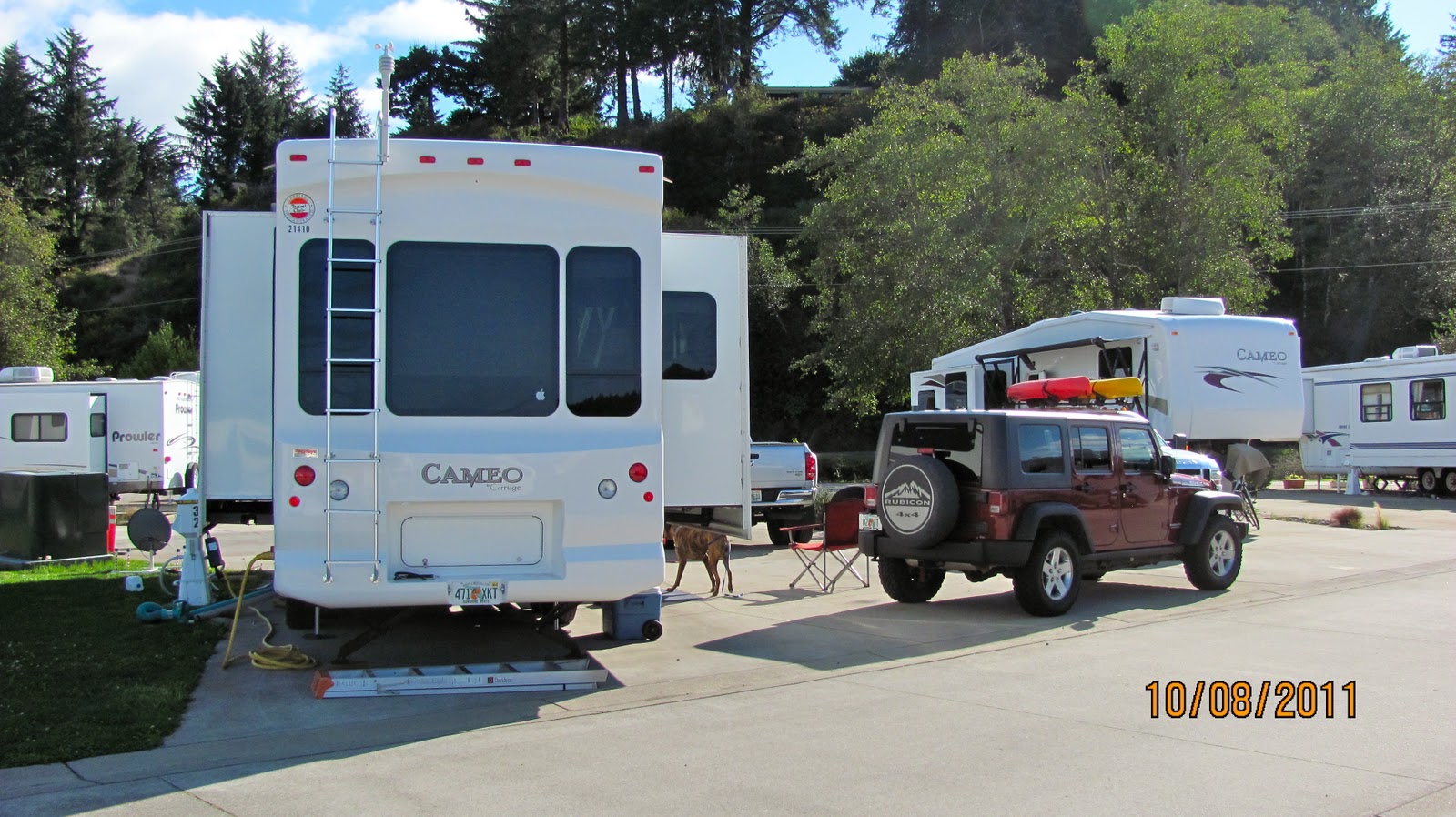
We didn't have great expectations so we were pleasantly surprised when we arrived at Casey's Riverside RV Park. It's a beautiful park on the Willamette River surrounded by the Willamette Forest. The sound from the rushing waters of the river was just beautiful. We were assigned pull through sites 48 and 49 facing the river.
We paid $74 dollars including tax for two nights with full hook-ups to include cable and WiFi. It was a bit more than we like to play at $37 a night with the GoodSam discount! However, the sites were beautiful as was the park.
Truly a beautiful park about 6 miles from the small town of Oakridge that has the necessary fuel and shopping amenities. After getting set up Paul and I drove into Oakridge to buy diesel fuel paying $4.05 a gallon. We also stopped at the Forest Ranger Office near the park to get information on hikes in the area.
The next day, we took the Jeep into Westfir, a very small town with minimal services. However, we were only passing through on our way to a hike driving through the covered "Office Bridge" built in 1945.
It was a beautiful day for a hike and it felt to good to be out enjoying nature as we did a hike along the North Fork of the Willamette River.
The Willamette Forest is very dense and moss grows everywhere and clings to the trees.
We got back to the Jeep after hiking 5 miles. Perhaps a bit too far considering we hadn't been hiking over the last few weeks. I know my feet were sore as my Plantar Fasciitis flared up. But you know...it kinda felt good! Later we explored some more of the town and did some grocery shopping in Oakridge.
The morning of the 15th we got hitched up and set out for a state park near Crater Lake National Park.

Tuesday, October 11, 2011

Exploring the Oregon Coast

October 11, 2011 McKinley's Marina and RV Park Waldport, Oregon.
The weather has been miserable the last couple of days. Dealing with the wind, rain and fog makes us all yearn to head south and chase the sun. 
We have made a new friend here in the park, Danine. She recently moved to Oregon and this park to begin a career with the local power company. Unfortunately she had to leave her home and husband in Arizona while they wait to sell their house and he searches for work in Oregon, unfortunate hostages to the current state of the economy and housing market. 
Joyce and Danine
A couple days ago, Denine made an excellent Lasagna dish for all of us! She's a Full Time RV'er having now lived in her rig since January. However, unlike us, she doesn't have the freedom to move much. We've really enjoyed her company.
This morning the sun came out so we decided to take advantage and head to the shore to explore and take pictures. First the four of us (Paul and Paula, Joyce and I) stopped for lunch and by the time we got on the road, the clouds were beginning to roll back in.
Joyce and Paula
Seal Point
Seal Point
Fighting the wind at Rocky Creek
We continued north up the coast to the "World's Smallest Harbor" Depoe Bay. 
Depoe Bay is a city in Lincoln CountyOregonUnited States, located on U.S. Route 101 next to the Pacific Ocean. The population was 1,174 at the 2000 census, with an unofficial estimated population of 1,355 in 2007. The bay of the same name is a six-acre (24,000 m²) harbor that the city promotes as the world's smallest.
The waves were crashing against the seawall along highway 101.

Below is the actual harbor with the entrance under the Highway 101 bridge. There's a small Coast Guard contingent in the harbor. Today the harbor was closed due to rough seas (above), with no boats coming in or out through the narrow passage to the harbor.
Heading South back towards Newport, we stopped at Cape Foulweather and checked out the views.
Cape Foulweather was discoverd and named in 1778 by the famous British navigator Captain James Cook. It was at this Point that Captain Cook first sighted the mainland of North America on the Pacific Coast, and one of the sudden storms which greeted his arrival almost put an end to his historical expedition. The fierceness of the storm is reflected by the name he gave this rugged landmark - Cape Foulweather.


By the time we got home we had been thoroughly soaked at least a couple of times having been caught in sudden rain storms. Oregon and Washington have some amazingly beautiful coast lines, but I could never get used to the weather.

Saturday, October 8, 2011

Camp Rilea to McKinley's Marina and RV Park, Waldport, Oregon

September 6-8, 2011 McKinley's Marina and RV Park Waldport, Oregon.


We enjoyed our stay at Camp Rilea taking advantage of the great rate ($20) and free laundry. We explored the local towns of Warrenton and Seaside and sampled some of the local cuisine.
Thursday, Sept. 6 we awoke to one of the prettiest sunny days of our stay as it has rained almost everyday. The temps have been in the low 60's during the day and 50's at night. But on this day we prepared to travel about 150 miles south along Hwy 101 to Waldport a small town just south of Newport, Oregon.


Turnout on Hwy. 101.
Rico and Maggie checking out the views
Hwy 101 is twisty and rough in many spots with some short steep climbs and descents. After driving about a third of the way we stopped at an overlook to check out the rugged coastline. 

The rugged Oregon Coast in the ever present fog and mist.
Scenic Hwy 101
Just north of Newport we again stopped at a scenic turnout and checked out the shoreline views. We were lucky that our travel day was one of the very few days that it didn't rain here in the Northwest during our visit.


Yaquina Head Lighthouse
We soon arrived at our destination, McKinley's Marina and RV Park located on the water in Waldport, Oregon. We got checked in and had our choice of a few sites including a couple on the water's edge. However, it was breezier and cooler close to the water. Therefore, we chose a couple of sites near the center of the park. We each paid just under $200 for a week's stay with full hook-ups, strong WiFi and cable (even though we set up our satellites). 
Our site: 32
The sites are designed to be buddy sites meaning we could pull in at opposing directions and thus have our doors opening towards the center of both sites. We took site 32 and Paul and Paula took site 33. 
Paul and Paula's site to the left of ours.
Because of the nearly constant rain, we chose this park for the big concrete pads. Although it perhaps would have been nice to go to a scenic state park, we all thought the concrete pads would be much better for rainy conditions. We all got set up and enjoyed the rest of this rare sunny day. The RV Park is attached to a small marina and there are lots of recreational fisherman occupying the RV sites. Many are engaged in fishing for Salmon and setting crab traps for Dungeness Crabs.
The following day it rained but we drove into Newport to check out the grocery stores and to visit one of the lighthouses. Specifically the Yaquina Head Lighthouse. Paul and Paula were interested in checking out this BLM location as they often advertise for volunteers. We checked out the visitor center and learned about some of the volunteer responsibilities. Perhaps not a bad volunteer job... in the summer!
Yaquina Head Lighthouse
The weather wasn't cooperating as it was cold, windy and sporadically raining. However, we all managed to pose for a picture.

Joyce and I on the left next to Paula and Paul
The Oregon coastline is as beautiful as it is rugged. We will be here in Waldport for a week and if the weather gives us a little bit of cooperation, we shall get out and explore the area some more.

Friday, September 30, 2011

Travel Day Salt Creek to Warrenton, Oregon Camp Rilea

Sept. 27, 2011. Port Angeles, Wa. to Warrenton, Or.


We woke to cloudy skies and threatening rain. We had extended one day (last night) here at Salt Creek Recreation Area in hopes of avoiding rain. It didn't look like avoiding the rain today was likely. In fact, after getting hitched up the rain started. We both moved over to the dump station to drain our tanks as the rain fell in earnest. I generally make it a rule to not to drive in the rain for a couple of reasons. A. It's more dangerous. B. It makes a mess of everything. However, we were already committed and the chances of avoiding rain west of the Cascades in the State of Washington for the next several days was almost non-existent.
Today we were pushing south on Hwy 101 for about 242 miles through Washington and into Oregon. We finished dumping and were on the road by 9:30. The hope was to move to an area with a better short term forecast. 
Highway 101 along the West coast of Washington is a very hilly winding two-lane highway heavily traveled by speeding monster log trucks. The highway travels through dense forests passing through just a few very small towns. It's rare to actually get a glimpse of the coast but, Paul leading the way, managed to find a turnout with a view for a quick break. 
Rough Surf.
Lighthouse on the island in the distance.
The off and on rain finally relented as we approached the Oregon state line. After several hours @3:30 we finally made it into the outskirts of Astoria, Oregon. Our destination was Camp Rilea in Warrenton, Oregon along the West Coast.
Entering Astoria, Oregon.
We quickly got checked in and set up in sites 1 and 2 at the end of the RV lot. There were only two other RVs at the far end.
Paul and Paula's rig in site 1, ours in site 2.
Camp Rilea is a beautifully maintained National Guard and Armed Forces Training Center. It's only available to active duty and retired military. However, we were allowed to use the facility as a guest of Paul who retired from the Coast Guard.
From atop the berm behind our rigs, we could see this small herd of elk. I couldn't get all of them into the frame of this picture. The elk wander around and have been seen in the fields in front of the rigs after dark.
The Camp Rilea RV facilities are basically a blacktop parking lot with full 50 amp hook-ups to include 50 plus channels of cable. There is no WiFi. A very nice bathroom and bath house facility is centered in the 10 site lot. 
We are schedule to stay till October 6th and paid $20 per night. The day after arriving we took it easy and washed the rig, truck and Jeep. Like I said, driving in the rain sure makes a mess of everything. We will use the location to explore portions of the coast and the surrounding areas.