

This morning temps were in the low 70's and expected to warm to the upper 90's. We decided to take an off-road adventure on Last Dollar Road, rated as "easy" in our Colorado off-road book.
The Last Dollar Road was an early supply route from Ouray to Telluride. It is not a difficult trail, and the road can be driven by high clearance 2 wheel drive vehicles in dry weather. Four wheel drive is required in any wet conditions. The Last Dollar Road offers beautiful vistas, high alpine meadows and views of the San Miguel canyon.
The Last Dollar Road starts off on a dirt County Road going past small ranches with fields of beautiful flowers.

The dirt road travels over high hills overlooking beautiful valleys.

Before long you turn off the County Road and begin driving on an increasingly narrow dirt road that begins to turn up into the mountains.

It's wet in spots from little streams that trickle down the sides of the mountains.

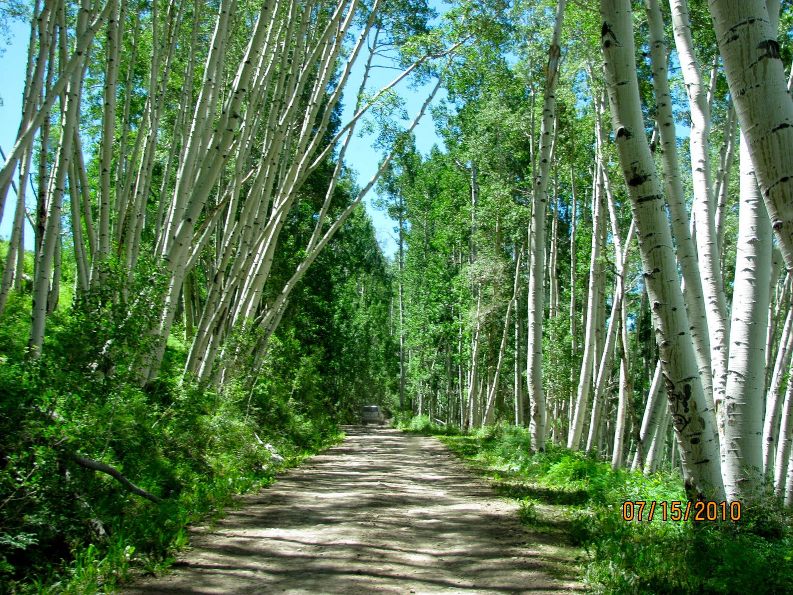
We drove through Aspen Forests. You can see another Jeep (that we later passed) ahead of us in this picture.
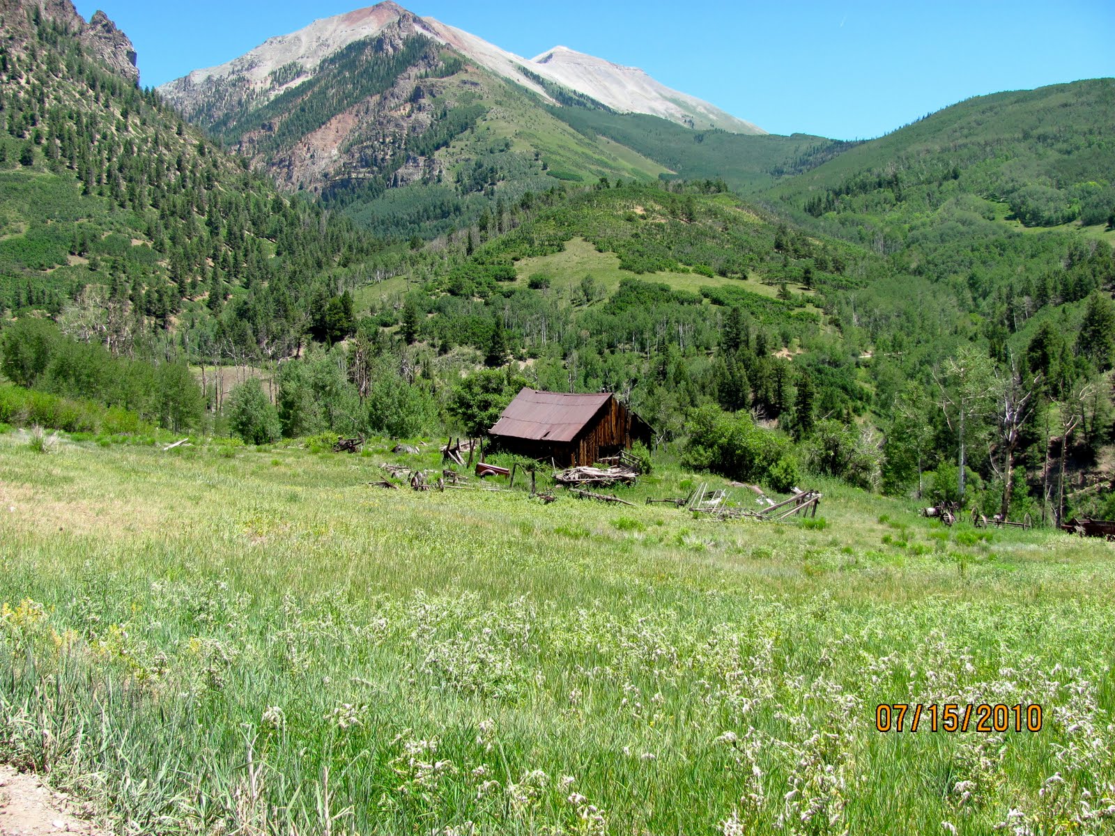
The Aspen Forests give way to beautiful mountain vistas.

Joyce thought I was gonna do a "Thelma and Louise" and launch ourselves off this cliff!

She was screaming like a school girl!

The views from the top were breath taking.

As we got higher we entered a pine forest.


The beautiful San Juan Mountains in the distance.

The road at this altitude was very narrow, rocky and full of ruts. I would not have been comfortable in anything but a Jeep or ATV. The road was too narrow in my opinion for a pick-up truck.

Thankfully, we didn't encounter any other vehicles going the opposite direction.

We began our descent into Telluride passing more privately owned farm land.
The road widened to a graded county maintained road.

We arrived in Telluride no worse for the wear after 20 miles of dirt roads and additional highway miles. It took us about an hour and 45 minutes of driving on the Last Dollar Road.
Telluride is located at an elevation of 8,750 feet in an isolated spot in the Four Corners region where Colorado, New Mexico, Utahand Arizona come together. From the west, Colorado Route 145 is the most common way into Telluride, however there are two alternate passes to enter the town as well.
The Town of Telluride is the county seat and most populous town of San Miguel County in the southwestern portion of the U.S. state of Colorado.[3] The town is a former silver mining camp on the San Miguel River in the western San Juan Mountains. TheTelluride Historic District, which includes a significant portion of the town, is listed on the National Register of Historic Places and is also one of Colorado's 20 National Historic Landmarks. The town population was 2,221 at U.S. Census 2000.

Telluride sits in a box canyon. Steep forested mountains and cliffs surround it. Bridal Veil Falls is at the head of the canyon. Numerous weathered ruins of old mining operations dot the hillsides. A free gondola connects the town with its companion townMountain Village, Colorado at the base of the ski area.

Telluride and the surrounding area have featured prominently in pop culture. The town of Telluride has served as the backdrop for several television commercials, is home to an international film festival, and has been the subject of songs such as "Smugglers Blues" by Glenn Frey, an essay by Edward Abbey, and eponymous songs by The Nitty Gritty Dirt Band, Kate Wolf, and Tim McGraw. Telluride is also known for its ski resort and slopes during the winter as well as an extensive festival schedule during the summer.

Beyond the ski lifts, Telluride is now widely recognized as a premier all-season resort. Telluride Ski Resort is definitely the main attraction in the winter. But when summer comes around, Telluride transforms into an outdoor recreation hot spot, with tourists visiting to enjoy a wide range of activities including but not limited to mountain biking, hiking, river rafting, sightseeing and more. The Telluride Tourism Board promotes tourism in the region.

After walking around town and avoiding the over-priced tourist shops, we stopped at an outdoor taco stand (imagine that) for lunch. Later we drove to the east end of town where the only way out is up and over Bridal Veil Falls and the two 4x4 passes.
On the eastern side of town, or the falls side, Bridal Veil Falls and the Generator House which sits at the top of the falls overlook the Victorian section of town. The power plant house is owned by Eric Jacobson, who restored the house and the generator inside, which now provides about 25 percent of Telluride with its electricity. The house was originally used to power the Smuggler-Union Mine and requires an aerial tramway for Jacobson and his family to get home. It is the second-oldest operating AC generator in the United States, the first being the Ames Hydroelectric Generating Plant near Ophir, Colorado, also in San Miguel County.

There is at least three falls. Bridal Falls and the generator house are in the picture below just right of the picture above.

We had a great time especially on the off-road trip to Telluride. However, we took the much faster highway on the way home!
Absolutely breathtaking scenery!
ReplyDeleteConnie